You are here: Home > Network List > UW - Pacific Northwest Regional Seismic Network Stations List
> Station HOOD Mt Hood Meadows, OR CREST BB SMO > Earthquake Result Viewer
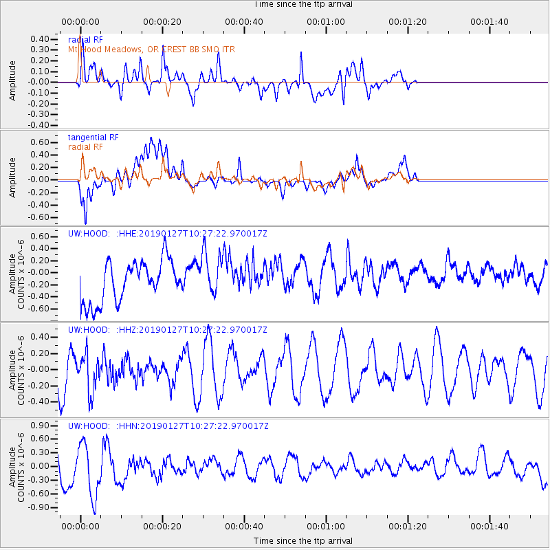
HOOD Mt Hood Meadows, OR CREST BB SMO - Earthquake Result Viewer
*The percent match for this event was below the threshold and hence no stack was calculated.
| Earthquake location: |
Fiji Islands Region |
| Earthquake latitude/longitude: |
-20.1/-177.8 |
| Earthquake time(UTC): |
2019/01/27 (027) 10:16:27 GMT |
| Earthquake Depth: |
550 km |
| Earthquake Magnitude: |
5.8 Mww |
| Earthquake Catalog/Contributor: |
NEIC PDE/us |
|
| Network: |
UW Pacific Northwest Regional Seismic Network |
| Station: |
HOOD Mt Hood Meadows, OR CREST BB SMO |
| Lat/Lon: |
45.32 N/121.65 W |
| Elevation: |
1520 m |
|
| Distance: |
82.7 deg |
| Az: |
36.207 deg |
| Baz: |
231.886 deg |
| Ray Param: |
$rayparam |
*The percent match for this event was below the threshold and hence was not used in the summary stack. |
|
| Radial Match: |
40.78871 % |
| Radial Bump: |
400 |
| Transverse Match: |
49.18748 % |
| Transverse Bump: |
400 |
| SOD ConfigId: |
13570011 |
| Insert Time: |
2019-05-02 10:15:33.838 +0000 |
| GWidth: |
2.5 |
| Max Bumps: |
400 |
| Tol: |
0.001 |
|
Signal To Noise
| Channel | StoN | STA | LTA |
| UW:HOOD: :HHZ:20190127T10:27:22.970017Z | 0.82701355 | 2.3147206E-7 | 2.798891E-7 |
| UW:HOOD: :HHN:20190127T10:27:22.970017Z | 1.8178532 | 6.129107E-7 | 3.3716182E-7 |
| UW:HOOD: :HHE:20190127T10:27:22.970017Z | 1.0567462 | 3.5859605E-7 | 3.393398E-7 |
| Arrivals |
| Ps | |
| PpPs | |
| PsPs/PpSs | |


