You are here: Home > Network List > TA - USArray Transportable Network (new EarthScope stations) Stations List
> Station K24A Anderson Ranch, Keeline, WY, USA > Earthquake Result Viewer
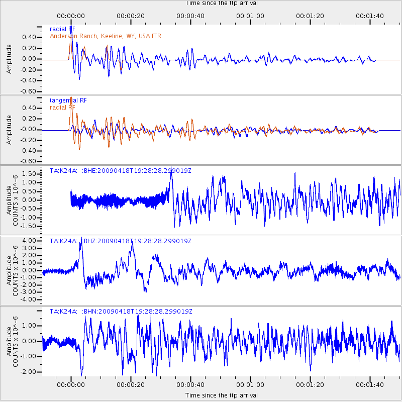
K24A Anderson Ranch, Keeline, WY, USA - Earthquake Result Viewer

| Earthquake location: |
Kuril Islands |
| Earthquake latitude/longitude: |
46.0/151.4 |
| Earthquake time(UTC): |
2009/04/18 (108) 19:17:58 GMT |
| Earthquake Depth: |
35 km |
| Earthquake Magnitude: |
6.3 MB, 6.3 MS, 6.6 MW, 6.4 MW |
| Earthquake Catalog/Contributor: |
WHDF/NEIC |
|
| Network: |
TA USArray Transportable Network (new EarthScope stations) |
| Station: |
K24A Anderson Ranch, Keeline, WY, USA |
| Lat/Lon: |
42.72 N/104.82 W |
| Elevation: |
1593 m |
|
| Distance: |
68.7 deg |
| Az: |
50.181 deg |
| Baz: |
313.419 deg |
| Ray Param: |
0.056054182 |
| Estimated Moho Depth: |
43.5 km |
| Estimated Crust Vp/Vs: |
1.63 |
| Assumed Crust Vp: |
6.159 km/s |
| Estimated Crust Vs: |
3.773 km/s |
| Estimated Crust Poisson's Ratio: |
0.20 |
|
| Radial Match: |
88.04687 % |
| Radial Bump: |
400 |
| Transverse Match: |
76.24855 % |
| Transverse Bump: |
400 |
| SOD ConfigId: |
2760 |
| Insert Time: |
2010-03-06 19:48:13.160 +0000 |
| GWidth: |
2.5 |
| Max Bumps: |
400 |
| Tol: |
0.001 |
|
Signal To Noise
| Channel | StoN | STA | LTA |
| TA:K24A: :BHZ:20090418T19:28:28.299019Z | 4.8929224 | 1.7759942E-6 | 3.629721E-7 |
| TA:K24A: :BHN:20090418T19:28:28.299019Z | 2.268587 | 8.4766396E-7 | 3.7365282E-7 |
| TA:K24A: :BHE:20090418T19:28:28.299019Z | 3.6306558 | 7.272403E-7 | 2.003055E-7 |
| Arrivals |
| Ps | 4.6 SECOND |
| PpPs | 18 SECOND |
| PsPs/PpSs | 23 SECOND |


