You are here: Home > Network List > UW - Pacific Northwest Regional Seismic Network Stations List
> Station UMAT Pilot Rock, OR, USA > Earthquake Result Viewer
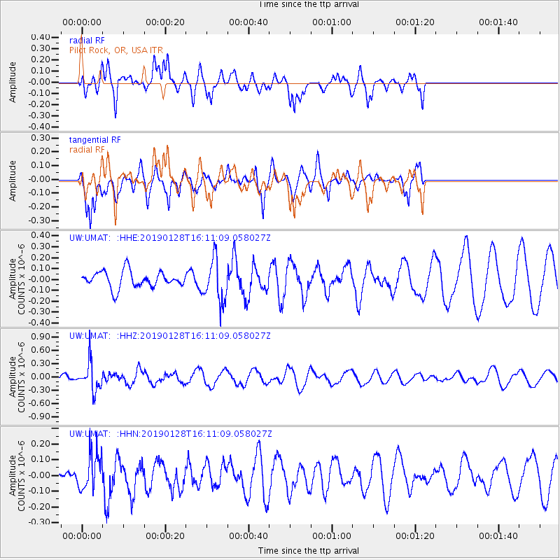
UMAT Pilot Rock, OR, USA - Earthquake Result Viewer
*The percent match for this event was below the threshold and hence no stack was calculated.
| Earthquake location: |
Fiji Islands Region |
| Earthquake latitude/longitude: |
-18.0/-179.3 |
| Earthquake time(UTC): |
2019/01/28 (028) 16:00:16 GMT |
| Earthquake Depth: |
621 km |
| Earthquake Magnitude: |
5.5 Mww |
| Earthquake Catalog/Contributor: |
NEIC PDE/us |
|
| Network: |
UW Pacific Northwest Regional Seismic Network |
| Station: |
UMAT Pilot Rock, OR, USA |
| Lat/Lon: |
45.29 N/118.96 W |
| Elevation: |
1318 m |
|
| Distance: |
83.4 deg |
| Az: |
38.118 deg |
| Baz: |
236.331 deg |
| Ray Param: |
$rayparam |
*The percent match for this event was below the threshold and hence was not used in the summary stack. |
|
| Radial Match: |
81.032875 % |
| Radial Bump: |
371 |
| Transverse Match: |
68.26791 % |
| Transverse Bump: |
344 |
| SOD ConfigId: |
13570011 |
| Insert Time: |
2019-05-02 10:22:49.504 +0000 |
| GWidth: |
2.5 |
| Max Bumps: |
400 |
| Tol: |
0.001 |
|
Signal To Noise
| Channel | StoN | STA | LTA |
| UW:UMAT: :HHZ:20190128T16:11:09.058027Z | 3.1577067 | 3.3061087E-7 | 1.0469968E-7 |
| UW:UMAT: :HHN:20190128T16:11:09.058027Z | 1.0321298 | 1.1950837E-7 | 1.15788126E-7 |
| UW:UMAT: :HHE:20190128T16:11:09.058027Z | 2.6557658 | 1.9940111E-7 | 7.508234E-8 |
| Arrivals |
| Ps | |
| PpPs | |
| PsPs/PpSs | |


