E22A Miles City, MT, USA - Earthquake Result Viewer
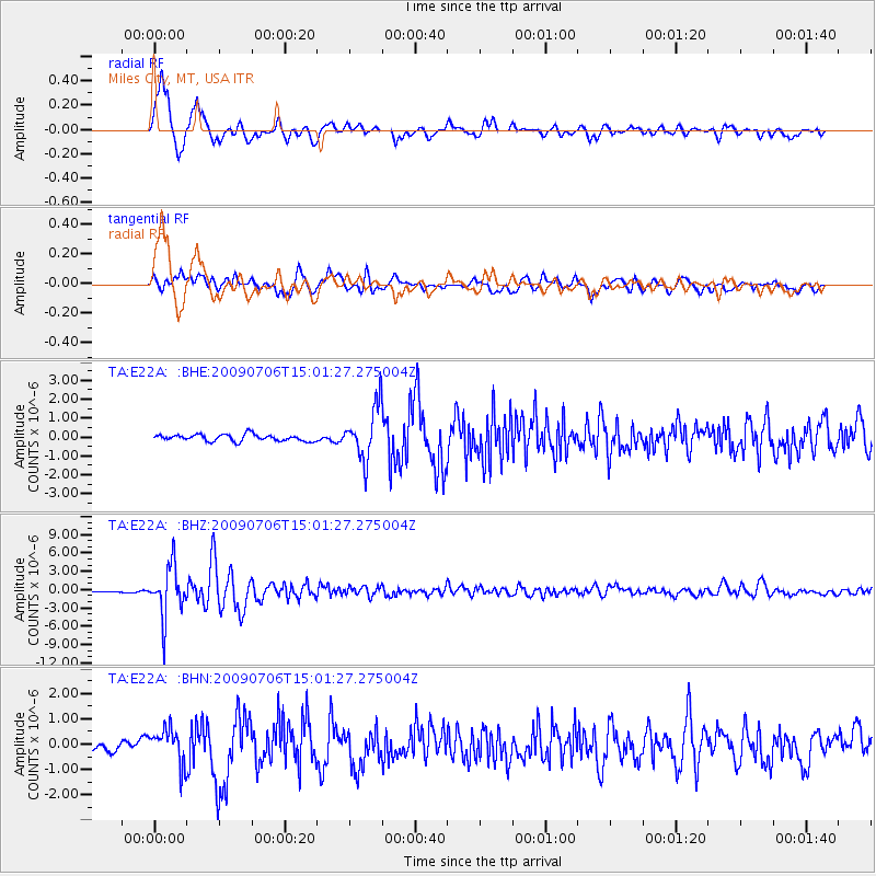
Earthquake location: Rat Islands, Aleutian Islands
Earthquake latitude/longitude: 50.4/177.0
Earthquake time(UTC): 2009/07/06 (187) 14:53:12 GMT
Earthquake Depth: 22 km
Earthquake Magnitude: 6.0 MB, 5.8 MS, 6.1 MW, 6.0 MW
Earthquake Catalog/Contributor: WHDF/NEIC
Network: TA USArray Transportable Network (new EarthScope stations)
Station: E22A Miles City, MT, USA
Lat/Lon: 46.44 N/105.95 W
Elevation: 784 m
Distance: 49.1 deg
Az: 63.038 deg
Baz: 304.492 deg
Ray Param: 0.068867534
Estimated Moho Depth: 19.25 km
Estimated Crust Vp/Vs: 1.62
Assumed Crust Vp: 6.438 km/s
Estimated Crust Vs: 3.98 km/s
Estimated Crust Poisson's Ratio: 0.19
Radial Match: 90.45025 %
Radial Bump: 400
Transverse Match: 76.99654 %
Transverse Bump: 400
SOD ConfigId: 2648
Insert Time: 2010-03-06 19:49:56.941 +0000
GWidth: 2.5
Max Bumps: 400
Tol: 0.001

Signal To Noise

ChannelStoNSTALTA
TA:E22A: :BHZ:20090706T15:01:27.275004Z29.8521084.1267294E-61.3823913E-7
TA:E22A: :BHN:20090706T15:01:27.275004Z4.14560376.935713E-71.6730286E-7
TA:E22A: :BHE:20090706T15:01:27.275004Z8.0279281.4137404E-61.7610277E-7
Arrivals
Ps2.0 SECOND
PpPs7.3 SECOND
PsPs/PpSs9.3 SECOND