You are here: Home > Network List > TA - USArray Transportable Network (new EarthScope stations) Stations List
> Station E22A Miles City, MT, USA > Earthquake Result Viewer
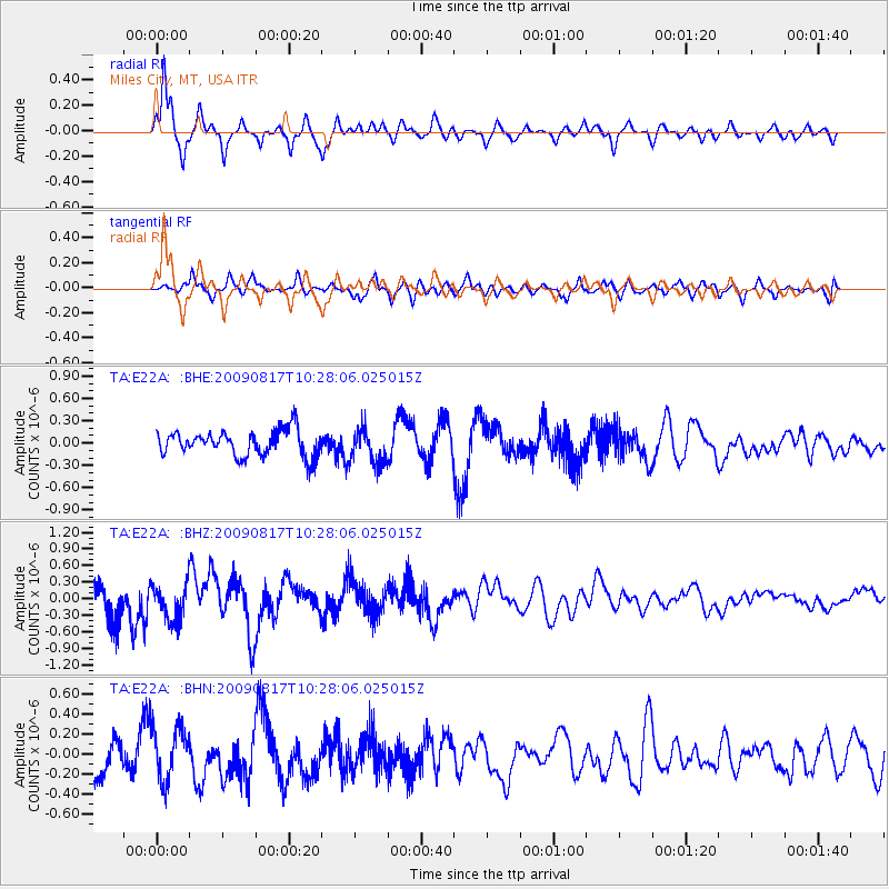
E22A Miles City, MT, USA - Earthquake Result Viewer
*The percent match for this event was below the threshold and hence no stack was calculated.
| Earthquake location: |
Southwestern Ryukyu Isl., Japan |
| Earthquake latitude/longitude: |
23.4/123.7 |
| Earthquake time(UTC): |
2009/08/17 (229) 10:15:05 GMT |
| Earthquake Depth: |
10 km |
| Earthquake Magnitude: |
5.7 MB |
| Earthquake Catalog/Contributor: |
WHDF/NEIC |
|
| Network: |
TA USArray Transportable Network (new EarthScope stations) |
| Station: |
E22A Miles City, MT, USA |
| Lat/Lon: |
46.44 N/105.95 W |
| Elevation: |
784 m |
|
| Distance: |
97.2 deg |
| Az: |
32.096 deg |
| Baz: |
315.108 deg |
| Ray Param: |
$rayparam |
*The percent match for this event was below the threshold and hence was not used in the summary stack. |
|
| Radial Match: |
79.98971 % |
| Radial Bump: |
334 |
| Transverse Match: |
61.022766 % |
| Transverse Bump: |
400 |
| SOD ConfigId: |
2622 |
| Insert Time: |
2010-03-06 19:50:26.289 +0000 |
| GWidth: |
2.5 |
| Max Bumps: |
400 |
| Tol: |
0.001 |
|
Signal To Noise
| Channel | StoN | STA | LTA |
| TA:E22A: :BHZ:20090817T10:28:06.025015Z | 1.131518 | 3.3301293E-7 | 2.9430635E-7 |
| TA:E22A: :BHN:20090817T10:28:06.025015Z | 1.5709603 | 2.690504E-7 | 1.7126492E-7 |
| TA:E22A: :BHE:20090817T10:28:06.025015Z | 1.3768392 | 2.3773894E-7 | 1.726701E-7 |
| Arrivals |
| Ps | |
| PpPs | |
| PsPs/PpSs | |


