You are here: Home > Network List > TS - TERRAscope (Southern California Seismic Network) Stations List
> Station CALB Calabasas, California, USA > Earthquake Result Viewer
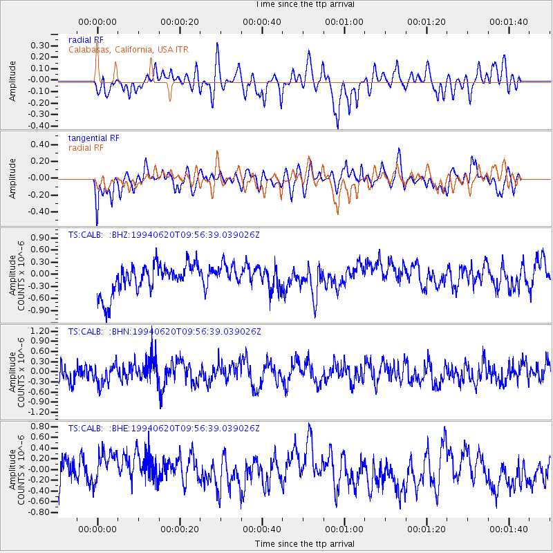
CALB Calabasas, California, USA - Earthquake Result Viewer
*The percent match for this event was below the threshold and hence no stack was calculated.
| Earthquake location: |
Kermadec Islands Region |
| Earthquake latitude/longitude: |
-28.8/-176.9 |
| Earthquake time(UTC): |
1994/06/20 (171) 09:44:46 GMT |
| Earthquake Depth: |
33 km |
| Earthquake Magnitude: |
5.8 MS, 5.2 MB, 5.9 UNKNOWN |
| Earthquake Catalog/Contributor: |
WHDF/NEIC |
|
| Network: |
TS TERRAscope (Southern California Seismic Network) |
| Station: |
CALB Calabasas, California, USA |
| Lat/Lon: |
34.14 N/118.63 W |
| Elevation: |
0.0 m |
|
| Distance: |
83.3 deg |
| Az: |
45.224 deg |
| Baz: |
228.725 deg |
| Ray Param: |
$rayparam |
*The percent match for this event was below the threshold and hence was not used in the summary stack. |
|
| Radial Match: |
51.401833 % |
| Radial Bump: |
400 |
| Transverse Match: |
53.253647 % |
| Transverse Bump: |
400 |
| SOD ConfigId: |
4480 |
| Insert Time: |
2010-02-26 14:04:53.282 +0000 |
| GWidth: |
2.5 |
| Max Bumps: |
400 |
| Tol: |
0.001 |
|
Signal To Noise
| Channel | StoN | STA | LTA |
| TS:CALB: :BHN:19940620T09:56:39.039026Z | 1.4353225 | 3.2980523E-7 | 2.297778E-7 |
| TS:CALB: :BHE:19940620T09:56:39.039026Z | 1.4771599 | 4.1823284E-7 | 2.831331E-7 |
| TS:CALB: :BHZ:19940620T09:56:39.039026Z | 0.7815797 | 2.8745416E-7 | 3.6778613E-7 |
| Arrivals |
| Ps | |
| PpPs | |
| PsPs/PpSs | |


