You are here: Home > Network List > TA - USArray Transportable Network (new EarthScope stations) Stations List
> Station E23A Ismay, MT, USA > Earthquake Result Viewer
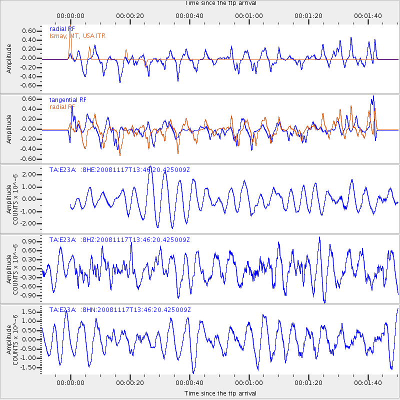
E23A Ismay, MT, USA - Earthquake Result Viewer
*The percent match for this event was below the threshold and hence no stack was calculated.
| Earthquake location: |
Arctic Ocean |
| Earthquake latitude/longitude: |
79.7/-115.7 |
| Earthquake time(UTC): |
2008/11/17 (322) 13:40:11 GMT |
| Earthquake Depth: |
10 km |
| Earthquake Magnitude: |
5.7 ML, 5.1 MB |
| Earthquake Catalog/Contributor: |
WHDF/NEIC |
|
| Network: |
TA USArray Transportable Network (new EarthScope stations) |
| Station: |
E23A Ismay, MT, USA |
| Lat/Lon: |
46.50 N/105.31 W |
| Elevation: |
750 m |
|
| Distance: |
33.5 deg |
| Az: |
167.017 deg |
| Baz: |
356.639 deg |
| Ray Param: |
$rayparam |
*The percent match for this event was below the threshold and hence was not used in the summary stack. |
|
| Radial Match: |
66.58252 % |
| Radial Bump: |
400 |
| Transverse Match: |
37.96935 % |
| Transverse Bump: |
400 |
| SOD ConfigId: |
2658 |
| Insert Time: |
2010-03-06 19:52:33.306 +0000 |
| GWidth: |
2.5 |
| Max Bumps: |
400 |
| Tol: |
0.001 |
|
Signal To Noise
| Channel | StoN | STA | LTA |
| TA:E23A: :BHZ:20081117T13:46:20.425009Z | 0.8554987 | 2.9485025E-7 | 3.446531E-7 |
| TA:E23A: :BHN:20081117T13:46:20.425009Z | 0.9925676 | 7.0245153E-7 | 7.0771154E-7 |
| TA:E23A: :BHE:20081117T13:46:20.425009Z | 2.663943 | 1.6901105E-6 | 6.344394E-7 |
| Arrivals |
| Ps | |
| PpPs | |
| PsPs/PpSs | |


