You are here: Home > Network List > TA - USArray Transportable Network (new EarthScope stations) Stations List
> Station E23A Ismay, MT, USA > Earthquake Result Viewer
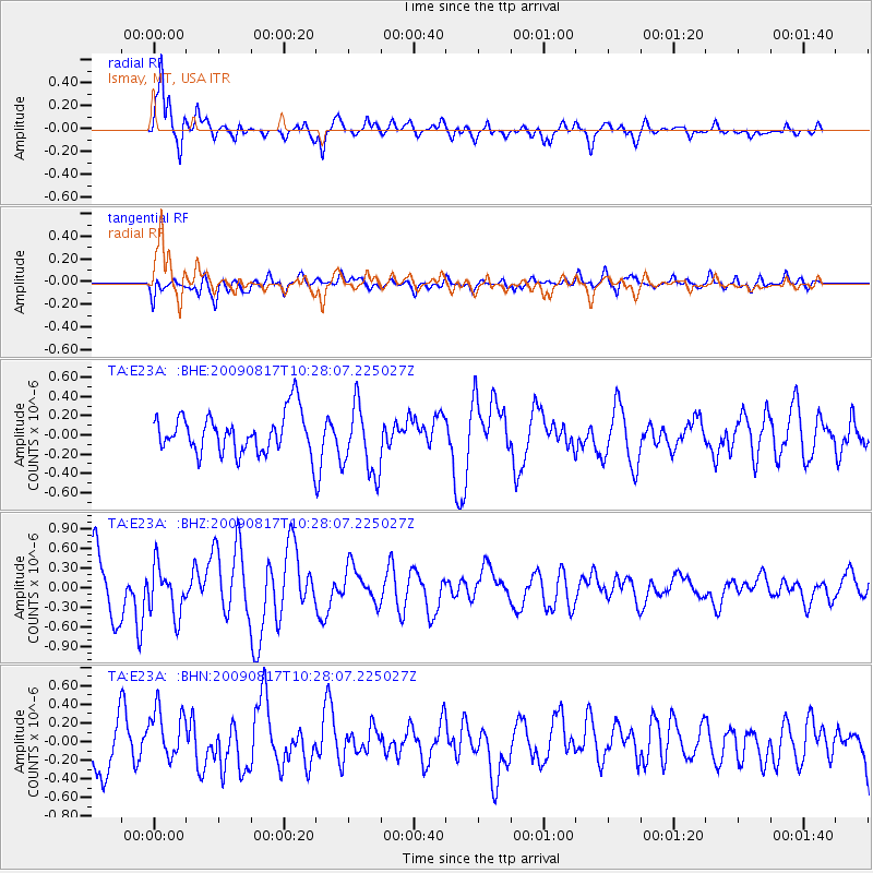
E23A Ismay, MT, USA - Earthquake Result Viewer
*The percent match for this event was below the threshold and hence no stack was calculated.
| Earthquake location: |
Southwestern Ryukyu Isl., Japan |
| Earthquake latitude/longitude: |
23.4/123.7 |
| Earthquake time(UTC): |
2009/08/17 (229) 10:15:05 GMT |
| Earthquake Depth: |
10 km |
| Earthquake Magnitude: |
5.7 MB |
| Earthquake Catalog/Contributor: |
WHDF/NEIC |
|
| Network: |
TA USArray Transportable Network (new EarthScope stations) |
| Station: |
E23A Ismay, MT, USA |
| Lat/Lon: |
46.50 N/105.31 W |
| Elevation: |
750 m |
|
| Distance: |
97.5 deg |
| Az: |
31.735 deg |
| Baz: |
315.619 deg |
| Ray Param: |
$rayparam |
*The percent match for this event was below the threshold and hence was not used in the summary stack. |
|
| Radial Match: |
89.152016 % |
| Radial Bump: |
395 |
| Transverse Match: |
60.842926 % |
| Transverse Bump: |
400 |
| SOD ConfigId: |
2622 |
| Insert Time: |
2010-03-06 19:52:39.831 +0000 |
| GWidth: |
2.5 |
| Max Bumps: |
400 |
| Tol: |
0.001 |
|
Signal To Noise
| Channel | StoN | STA | LTA |
| TA:E23A: :BHZ:20090817T10:28:07.225027Z | 1.1677746 | 3.7389157E-7 | 3.2017445E-7 |
| TA:E23A: :BHN:20090817T10:28:07.225027Z | 1.3925788 | 2.7618418E-7 | 1.983257E-7 |
| TA:E23A: :BHE:20090817T10:28:07.225027Z | 1.7338471 | 3.6063972E-7 | 2.0799972E-7 |
| Arrivals |
| Ps | |
| PpPs | |
| PsPs/PpSs | |


