You are here: Home > Network List > TA - USArray Transportable Network (new EarthScope stations) Stations List
> Station E23A Ismay, MT, USA > Earthquake Result Viewer
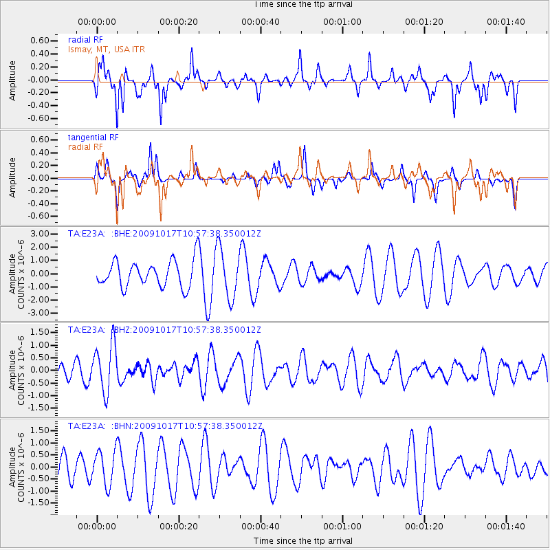
E23A Ismay, MT, USA - Earthquake Result Viewer
*The percent match for this event was below the threshold and hence no stack was calculated.
| Earthquake location: |
Samoa Islands Region |
| Earthquake latitude/longitude: |
-16.4/-172.0 |
| Earthquake time(UTC): |
2009/10/17 (290) 10:45:26 GMT |
| Earthquake Depth: |
10 km |
| Earthquake Magnitude: |
5.7 MB, 5.3 MS, 5.7 MW, 5.7 MW |
| Earthquake Catalog/Contributor: |
WHDF/NEIC |
|
| Network: |
TA USArray Transportable Network (new EarthScope stations) |
| Station: |
E23A Ismay, MT, USA |
| Lat/Lon: |
46.50 N/105.31 W |
| Elevation: |
750 m |
|
| Distance: |
86.6 deg |
| Az: |
39.459 deg |
| Baz: |
242.027 deg |
| Ray Param: |
$rayparam |
*The percent match for this event was below the threshold and hence was not used in the summary stack. |
|
| Radial Match: |
50.262352 % |
| Radial Bump: |
323 |
| Transverse Match: |
41.04642 % |
| Transverse Bump: |
209 |
| SOD ConfigId: |
2622 |
| Insert Time: |
2010-03-06 19:52:58.037 +0000 |
| GWidth: |
2.5 |
| Max Bumps: |
400 |
| Tol: |
0.001 |
|
Signal To Noise
| Channel | StoN | STA | LTA |
| TA:E23A: :BHZ:20091017T10:57:38.350012Z | 2.6215644 | 9.875429E-7 | 3.7669983E-7 |
| TA:E23A: :BHN:20091017T10:57:38.350012Z | 0.9878301 | 7.3482795E-7 | 7.438809E-7 |
| TA:E23A: :BHE:20091017T10:57:38.350012Z | 1.9203068 | 1.9168579E-6 | 9.98204E-7 |
| Arrivals |
| Ps | |
| PpPs | |
| PsPs/PpSs | |


