You are here: Home > Network List > TA - USArray Transportable Network (new EarthScope stations) Stations List
> Station E23A Ismay, MT, USA > Earthquake Result Viewer
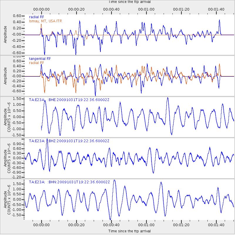
E23A Ismay, MT, USA - Earthquake Result Viewer
*The percent match for this event was below the threshold and hence no stack was calculated.
| Earthquake location: |
Santa Cruz Islands |
| Earthquake latitude/longitude: |
-11.4/166.4 |
| Earthquake time(UTC): |
2009/10/31 (304) 19:09:51 GMT |
| Earthquake Depth: |
134 km |
| Earthquake Magnitude: |
5.9 MB, 5.9 MW, 5.9 MW |
| Earthquake Catalog/Contributor: |
WHDF/NEIC |
|
| Network: |
TA USArray Transportable Network (new EarthScope stations) |
| Station: |
E23A Ismay, MT, USA |
| Lat/Lon: |
46.50 N/105.31 W |
| Elevation: |
750 m |
|
| Distance: |
97.0 deg |
| Az: |
44.083 deg |
| Baz: |
260.946 deg |
| Ray Param: |
$rayparam |
*The percent match for this event was below the threshold and hence was not used in the summary stack. |
|
| Radial Match: |
56.34533 % |
| Radial Bump: |
341 |
| Transverse Match: |
64.1066 % |
| Transverse Bump: |
328 |
| SOD ConfigId: |
2622 |
| Insert Time: |
2010-03-06 19:53:06.585 +0000 |
| GWidth: |
2.5 |
| Max Bumps: |
400 |
| Tol: |
0.001 |
|
Signal To Noise
| Channel | StoN | STA | LTA |
| TA:E23A: :BHZ:20091031T19:22:36.60002Z | 2.3441162 | 6.235638E-7 | 2.6601234E-7 |
| TA:E23A: :BHN:20091031T19:22:36.60002Z | 1.1693797 | 5.3790166E-7 | 4.5998885E-7 |
| TA:E23A: :BHE:20091031T19:22:36.60002Z | 0.70218384 | 5.0846774E-7 | 7.2412337E-7 |
| Arrivals |
| Ps | |
| PpPs | |
| PsPs/PpSs | |


