You are here: Home > Network List > TA - USArray Transportable Network (new EarthScope stations) Stations List
> Station E23A Ismay, MT, USA > Earthquake Result Viewer
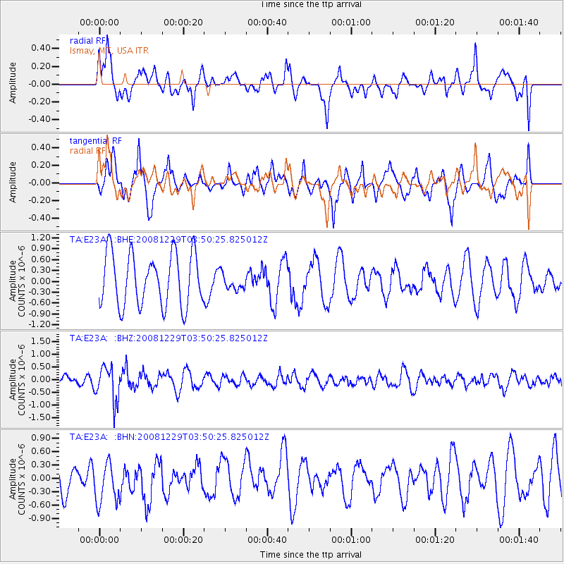
E23A Ismay, MT, USA - Earthquake Result Viewer
*The percent match for this event was below the threshold and hence no stack was calculated.
| Earthquake location: |
Afghanistan-Tajikistan Bord Reg. |
| Earthquake latitude/longitude: |
36.4/71.1 |
| Earthquake time(UTC): |
2008/12/29 (364) 03:37:41 GMT |
| Earthquake Depth: |
158 km |
| Earthquake Magnitude: |
5.9 MB, 5.8 MW, 5.8 MW |
| Earthquake Catalog/Contributor: |
WHDF/NEIC |
|
| Network: |
TA USArray Transportable Network (new EarthScope stations) |
| Station: |
E23A Ismay, MT, USA |
| Lat/Lon: |
46.50 N/105.31 W |
| Elevation: |
750 m |
|
| Distance: |
97.4 deg |
| Az: |
357.48 deg |
| Baz: |
2.944 deg |
| Ray Param: |
$rayparam |
*The percent match for this event was below the threshold and hence was not used in the summary stack. |
|
| Radial Match: |
40.45385 % |
| Radial Bump: |
400 |
| Transverse Match: |
53.472225 % |
| Transverse Bump: |
400 |
| SOD ConfigId: |
2658 |
| Insert Time: |
2010-03-06 19:53:27.012 +0000 |
| GWidth: |
2.5 |
| Max Bumps: |
400 |
| Tol: |
0.001 |
|
Signal To Noise
| Channel | StoN | STA | LTA |
| TA:E23A: :BHZ:20081229T03:50:25.825012Z | 3.6296833 | 6.869331E-7 | 1.892543E-7 |
| TA:E23A: :BHN:20081229T03:50:25.825012Z | 0.997246 | 5.1307546E-7 | 5.1449234E-7 |
| TA:E23A: :BHE:20081229T03:50:25.825012Z | 0.3013529 | 2.1893385E-7 | 7.2650323E-7 |
| Arrivals |
| Ps | |
| PpPs | |
| PsPs/PpSs | |


