You are here: Home > Network List > TA - USArray Transportable Network (new EarthScope stations) Stations List
> Station E23A Ismay, MT, USA > Earthquake Result Viewer
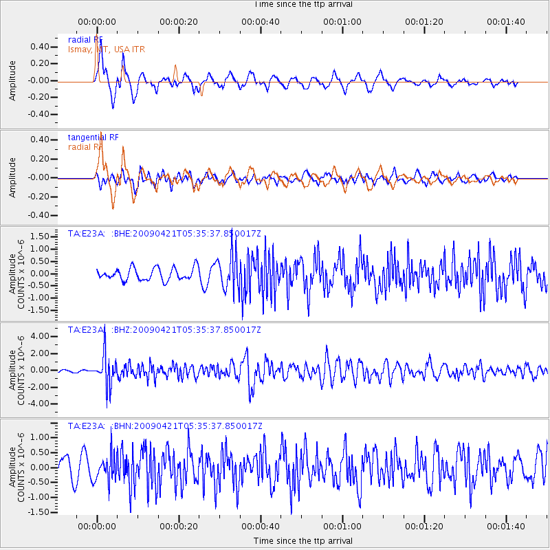
E23A Ismay, MT, USA - Earthquake Result Viewer
*The percent match for this event was below the threshold and hence no stack was calculated.
| Earthquake location: |
Kuril Islands |
| Earthquake latitude/longitude: |
50.8/155.0 |
| Earthquake time(UTC): |
2009/04/21 (111) 05:26:11 GMT |
| Earthquake Depth: |
152 km |
| Earthquake Magnitude: |
6.0 MB, 6.2 MW, 6.2 MW |
| Earthquake Catalog/Contributor: |
WHDF/NEIC |
|
| Network: |
TA USArray Transportable Network (new EarthScope stations) |
| Station: |
E23A Ismay, MT, USA |
| Lat/Lon: |
46.50 N/105.31 W |
| Elevation: |
750 m |
|
| Distance: |
61.0 deg |
| Az: |
51.157 deg |
| Baz: |
314.36 deg |
| Ray Param: |
$rayparam |
*The percent match for this event was below the threshold and hence was not used in the summary stack. |
|
| Radial Match: |
68.09943 % |
| Radial Bump: |
400 |
| Transverse Match: |
53.594635 % |
| Transverse Bump: |
400 |
| SOD ConfigId: |
2760 |
| Insert Time: |
2010-03-06 19:53:47.461 +0000 |
| GWidth: |
2.5 |
| Max Bumps: |
400 |
| Tol: |
0.001 |
|
Signal To Noise
| Channel | StoN | STA | LTA |
| TA:E23A: :BHZ:20090421T05:35:37.850017Z | 12.574064 | 1.8045107E-6 | 1.4351053E-7 |
| TA:E23A: :BHN:20090421T05:35:37.850017Z | 1.0793201 | 4.2064505E-7 | 3.897315E-7 |
| TA:E23A: :BHE:20090421T05:35:37.850017Z | 2.8302078 | 7.1296193E-7 | 2.5191153E-7 |
| Arrivals |
| Ps | |
| PpPs | |
| PsPs/PpSs | |


