You are here: Home > Network List > GS - US Geological Survey Networks Stations List
> Station KAN13 Rinehart Farm > Earthquake Result Viewer
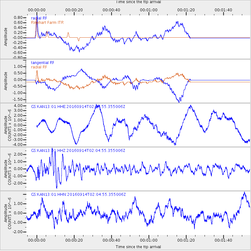
KAN13 Rinehart Farm - Earthquake Result Viewer
*The percent match for this event was below the threshold and hence no stack was calculated.
| Earthquake location: |
Northern Colombia |
| Earthquake latitude/longitude: |
7.3/-76.1 |
| Earthquake time(UTC): |
2016/09/14 (258) 01:58:30 GMT |
| Earthquake Depth: |
10 km |
| Earthquake Magnitude: |
5.9 MWP |
| Earthquake Catalog/Contributor: |
NEIC PDE/NEIC COMCAT |
|
| Network: |
GS US Geological Survey Networks |
| Station: |
KAN13 Rinehart Farm |
| Lat/Lon: |
37.01 N/97.48 W |
| Elevation: |
340 m |
|
| Distance: |
35.4 deg |
| Az: |
329.742 deg |
| Baz: |
141.358 deg |
| Ray Param: |
$rayparam |
*The percent match for this event was below the threshold and hence was not used in the summary stack. |
|
| Radial Match: |
46.40265 % |
| Radial Bump: |
400 |
| Transverse Match: |
38.247734 % |
| Transverse Bump: |
400 |
| SOD ConfigId: |
1634031 |
| Insert Time: |
2016-09-28 01:59:26.279 +0000 |
| GWidth: |
2.5 |
| Max Bumps: |
400 |
| Tol: |
0.001 |
|
Signal To Noise
| Channel | StoN | STA | LTA |
| GS:KAN13:01:HHZ:20160914T02:04:55.355006Z | 3.0085073 | 8.1602934E-7 | 2.712406E-7 |
| GS:KAN13:01:HHN:20160914T02:04:55.355006Z | 0.91882735 | 6.9391405E-7 | 7.55217E-7 |
| GS:KAN13:01:HHE:20160914T02:04:55.355006Z | 2.5154421 | 3.6081608E-6 | 1.4344042E-6 |
| Arrivals |
| Ps | |
| PpPs | |
| PsPs/PpSs | |


