You are here: Home > Network List > TA - USArray Transportable Network (new EarthScope stations) Stations List
> Station R23A Moffat, CO, USA > Earthquake Result Viewer
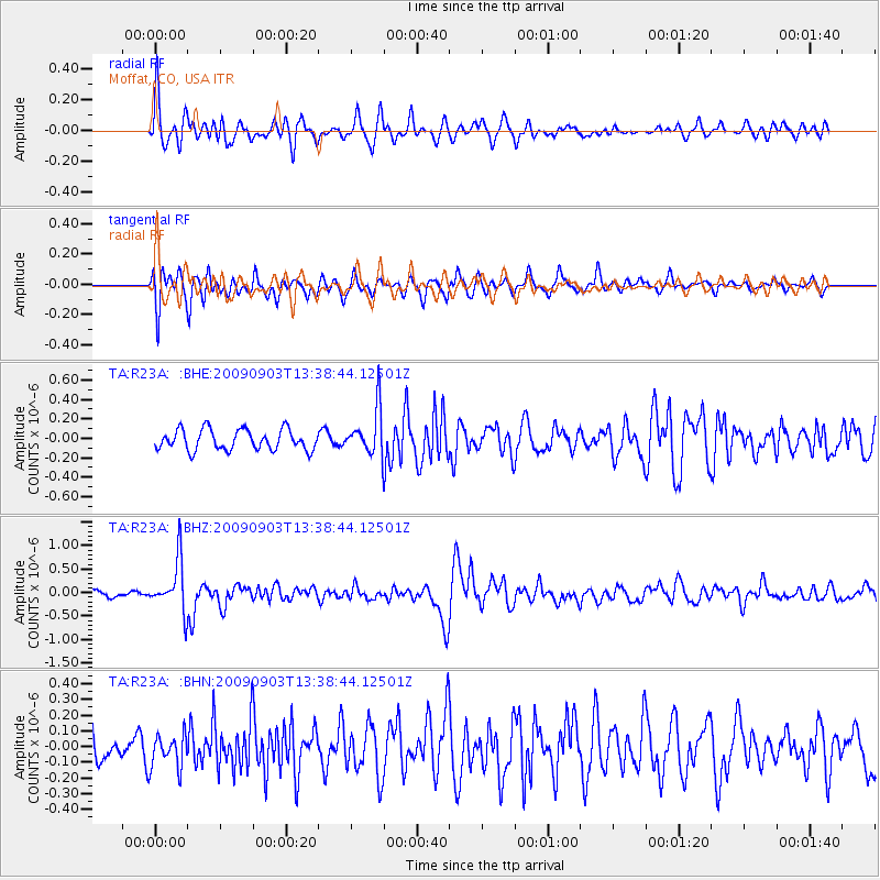
R23A Moffat, CO, USA - Earthquake Result Viewer
*The percent match for this event was below the threshold and hence no stack was calculated.
| Earthquake location: |
Kyushu, Japan |
| Earthquake latitude/longitude: |
31.1/130.0 |
| Earthquake time(UTC): |
2009/09/03 (246) 13:26:18 GMT |
| Earthquake Depth: |
166 km |
| Earthquake Magnitude: |
5.9 MB, 6.2 MW, 6.2 MW |
| Earthquake Catalog/Contributor: |
WHDF/NEIC |
|
| Network: |
TA USArray Transportable Network (new EarthScope stations) |
| Station: |
R23A Moffat, CO, USA |
| Lat/Lon: |
38.19 N/105.83 W |
| Elevation: |
2547 m |
|
| Distance: |
93.6 deg |
| Az: |
40.797 deg |
| Baz: |
314.687 deg |
| Ray Param: |
$rayparam |
*The percent match for this event was below the threshold and hence was not used in the summary stack. |
|
| Radial Match: |
76.58273 % |
| Radial Bump: |
400 |
| Transverse Match: |
67.34475 % |
| Transverse Bump: |
400 |
| SOD ConfigId: |
2622 |
| Insert Time: |
2010-03-06 19:54:43.758 +0000 |
| GWidth: |
2.5 |
| Max Bumps: |
400 |
| Tol: |
0.001 |
|
Signal To Noise
| Channel | StoN | STA | LTA |
| TA:R23A: :BHZ:20090903T13:38:44.12501Z | 5.6273985 | 5.3930506E-7 | 9.583559E-8 |
| TA:R23A: :BHN:20090903T13:38:44.12501Z | 0.84415394 | 1.04326546E-7 | 1.2358711E-7 |
| TA:R23A: :BHE:20090903T13:38:44.12501Z | 2.2656314 | 2.3733692E-7 | 1.04755316E-7 |
| Arrivals |
| Ps | |
| PpPs | |
| PsPs/PpSs | |


