You are here: Home > Network List > TA - USArray Transportable Network (new EarthScope stations) Stations List
> Station R23A Moffat, CO, USA > Earthquake Result Viewer
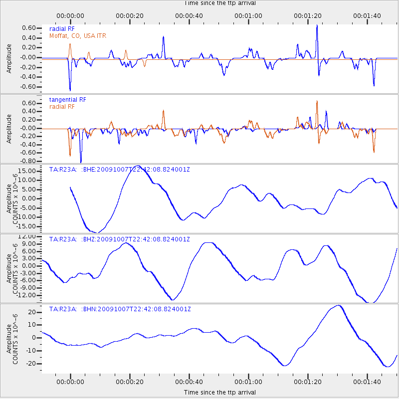
R23A Moffat, CO, USA - Earthquake Result Viewer
*The percent match for this event was below the threshold and hence no stack was calculated.
| Earthquake location: |
Santa Cruz Islands |
| Earthquake latitude/longitude: |
-11.5/166.0 |
| Earthquake time(UTC): |
2009/10/07 (280) 22:29:18 GMT |
| Earthquake Depth: |
35 km |
| Earthquake Magnitude: |
5.5 MB |
| Earthquake Catalog/Contributor: |
WHDF/NEIC |
|
| Network: |
TA USArray Transportable Network (new EarthScope stations) |
| Station: |
R23A Moffat, CO, USA |
| Lat/Lon: |
38.19 N/105.83 W |
| Elevation: |
2547 m |
|
| Distance: |
95.6 deg |
| Az: |
52.306 deg |
| Baz: |
259.83 deg |
| Ray Param: |
$rayparam |
*The percent match for this event was below the threshold and hence was not used in the summary stack. |
|
| Radial Match: |
87.87331 % |
| Radial Bump: |
304 |
| Transverse Match: |
59.281536 % |
| Transverse Bump: |
255 |
| SOD ConfigId: |
2622 |
| Insert Time: |
2010-03-06 19:54:49.059 +0000 |
| GWidth: |
2.5 |
| Max Bumps: |
400 |
| Tol: |
0.001 |
|
Signal To Noise
| Channel | StoN | STA | LTA |
| TA:R23A: :BHZ:20091007T22:42:08.824001Z | 0.95883083 | 4.9987602E-6 | 5.2133914E-6 |
| TA:R23A: :BHN:20091007T22:42:08.824001Z | 2.8630104 | 8.098495E-6 | 2.8286638E-6 |
| TA:R23A: :BHE:20091007T22:42:08.824001Z | 0.55109805 | 7.1195645E-6 | 1.2918871E-5 |
| Arrivals |
| Ps | |
| PpPs | |
| PsPs/PpSs | |


