You are here: Home > Network List > TA - USArray Transportable Network (new EarthScope stations) Stations List
> Station R23A Moffat, CO, USA > Earthquake Result Viewer
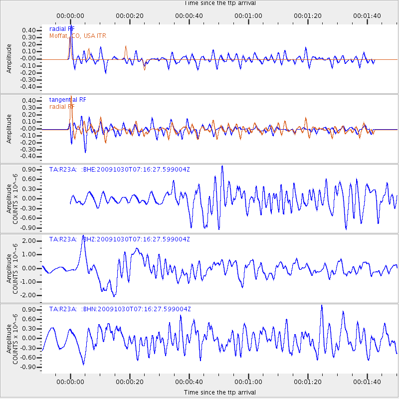
R23A Moffat, CO, USA - Earthquake Result Viewer
*The percent match for this event was below the threshold and hence no stack was calculated.
| Earthquake location: |
Ryukyu Islands, Japan |
| Earthquake latitude/longitude: |
29.2/129.8 |
| Earthquake time(UTC): |
2009/10/30 (303) 07:03:39 GMT |
| Earthquake Depth: |
34 km |
| Earthquake Magnitude: |
6.3 MB, 6.8 MS, 6.8 MW, 6.8 MW |
| Earthquake Catalog/Contributor: |
WHDF/NEIC |
|
| Network: |
TA USArray Transportable Network (new EarthScope stations) |
| Station: |
R23A Moffat, CO, USA |
| Lat/Lon: |
38.19 N/105.83 W |
| Elevation: |
2547 m |
|
| Distance: |
95.2 deg |
| Az: |
40.759 deg |
| Baz: |
313.59 deg |
| Ray Param: |
$rayparam |
*The percent match for this event was below the threshold and hence was not used in the summary stack. |
|
| Radial Match: |
74.24721 % |
| Radial Bump: |
400 |
| Transverse Match: |
71.50139 % |
| Transverse Bump: |
400 |
| SOD ConfigId: |
2622 |
| Insert Time: |
2010-03-06 19:54:49.829 +0000 |
| GWidth: |
2.5 |
| Max Bumps: |
400 |
| Tol: |
0.001 |
|
Signal To Noise
| Channel | StoN | STA | LTA |
| TA:R23A: :BHZ:20091030T07:16:27.599004Z | 5.2546616 | 1.0634781E-6 | 2.0238754E-7 |
| TA:R23A: :BHN:20091030T07:16:27.599004Z | 1.6864594 | 3.8072653E-7 | 2.2575493E-7 |
| TA:R23A: :BHE:20091030T07:16:27.599004Z | 1.9421657 | 2.157745E-7 | 1.11099936E-7 |
| Arrivals |
| Ps | |
| PpPs | |
| PsPs/PpSs | |


