You are here: Home > Network List > TA - USArray Transportable Network (new EarthScope stations) Stations List
> Station R23A Moffat, CO, USA > Earthquake Result Viewer
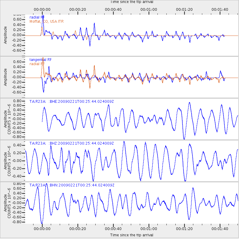
R23A Moffat, CO, USA - Earthquake Result Viewer
*The percent match for this event was below the threshold and hence no stack was calculated.
| Earthquake location: |
Ryukyu Islands, Japan |
| Earthquake latitude/longitude: |
28.9/130.9 |
| Earthquake time(UTC): |
2009/02/21 (052) 00:12:56 GMT |
| Earthquake Depth: |
24 km |
| Earthquake Magnitude: |
5.6 MB, 5.0 MS, 5.5 MW, 5.5 MW |
| Earthquake Catalog/Contributor: |
WHDF/NEIC |
|
| Network: |
TA USArray Transportable Network (new EarthScope stations) |
| Station: |
R23A Moffat, CO, USA |
| Lat/Lon: |
38.19 N/105.83 W |
| Elevation: |
2547 m |
|
| Distance: |
94.8 deg |
| Az: |
41.364 deg |
| Baz: |
312.647 deg |
| Ray Param: |
$rayparam |
*The percent match for this event was below the threshold and hence was not used in the summary stack. |
|
| Radial Match: |
58.68678 % |
| Radial Bump: |
333 |
| Transverse Match: |
70.830215 % |
| Transverse Bump: |
384 |
| SOD ConfigId: |
2658 |
| Insert Time: |
2010-03-06 19:54:51.818 +0000 |
| GWidth: |
2.5 |
| Max Bumps: |
400 |
| Tol: |
0.001 |
|
Signal To Noise
| Channel | StoN | STA | LTA |
| TA:R23A: :BHZ:20090221T00:25:44.024009Z | 0.7583378 | 1.896102E-7 | 2.5003396E-7 |
| TA:R23A: :BHN:20090221T00:25:44.024009Z | 2.7069116 | 5.8233815E-7 | 2.151301E-7 |
| TA:R23A: :BHE:20090221T00:25:44.024009Z | 0.94301707 | 2.5641359E-7 | 2.7190768E-7 |
| Arrivals |
| Ps | |
| PpPs | |
| PsPs/PpSs | |


