You are here: Home > Network List > TA - USArray Transportable Network (new EarthScope stations) Stations List
> Station R23A Moffat, CO, USA > Earthquake Result Viewer
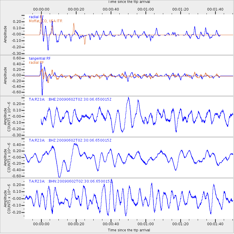
R23A Moffat, CO, USA - Earthquake Result Viewer
*The percent match for this event was below the threshold and hence no stack was calculated.
| Earthquake location: |
Vanuatu Islands |
| Earthquake latitude/longitude: |
-17.8/167.9 |
| Earthquake time(UTC): |
2009/06/02 (153) 02:17:03 GMT |
| Earthquake Depth: |
15 km |
| Earthquake Magnitude: |
5.7 MB, 6.2 MS, 6.3 MW, 6.3 MW |
| Earthquake Catalog/Contributor: |
WHDF/NEIC |
|
| Network: |
TA USArray Transportable Network (new EarthScope stations) |
| Station: |
R23A Moffat, CO, USA |
| Lat/Lon: |
38.19 N/105.83 W |
| Elevation: |
2547 m |
|
| Distance: |
97.9 deg |
| Az: |
52.539 deg |
| Baz: |
253.732 deg |
| Ray Param: |
$rayparam |
*The percent match for this event was below the threshold and hence was not used in the summary stack. |
|
| Radial Match: |
64.12573 % |
| Radial Bump: |
400 |
| Transverse Match: |
48.169617 % |
| Transverse Bump: |
400 |
| SOD ConfigId: |
2648 |
| Insert Time: |
2010-03-06 19:54:53.710 +0000 |
| GWidth: |
2.5 |
| Max Bumps: |
400 |
| Tol: |
0.001 |
|
Signal To Noise
| Channel | StoN | STA | LTA |
| TA:R23A: :BHZ:20090602T02:30:06.650015Z | 1.8767178 | 1.399374E-7 | 7.4564966E-8 |
| TA:R23A: :BHN:20090602T02:30:06.650015Z | 1.9686992 | 1.0090279E-7 | 5.1253533E-8 |
| TA:R23A: :BHE:20090602T02:30:06.650015Z | 1.0399076 | 7.9781174E-8 | 7.671949E-8 |
| Arrivals |
| Ps | |
| PpPs | |
| PsPs/PpSs | |


