You are here: Home > Network List > TA - USArray Transportable Network (new EarthScope stations) Stations List
> Station R23A Moffat, CO, USA > Earthquake Result Viewer
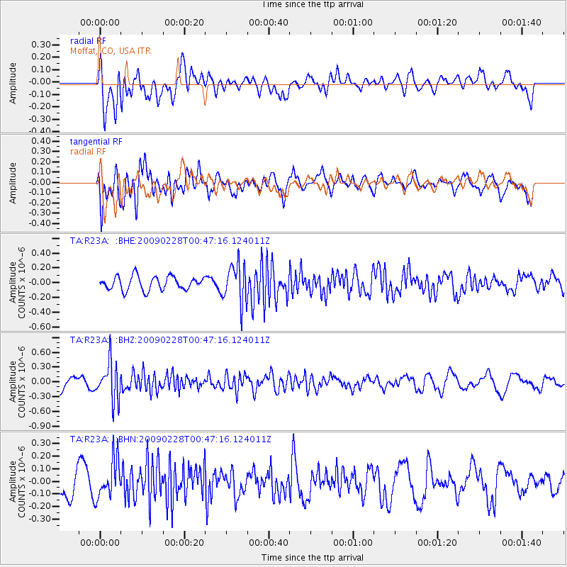
R23A Moffat, CO, USA - Earthquake Result Viewer
*The percent match for this event was below the threshold and hence no stack was calculated.
| Earthquake location: |
Hokkaido, Japan Region |
| Earthquake latitude/longitude: |
42.6/142.1 |
| Earthquake time(UTC): |
2009/02/28 (059) 00:35:56 GMT |
| Earthquake Depth: |
105 km |
| Earthquake Magnitude: |
5.5 MB, 5.5 MW, 5.5 MW |
| Earthquake Catalog/Contributor: |
WHDF/NEIC |
|
| Network: |
TA USArray Transportable Network (new EarthScope stations) |
| Station: |
R23A Moffat, CO, USA |
| Lat/Lon: |
38.19 N/105.83 W |
| Elevation: |
2547 m |
|
| Distance: |
78.7 deg |
| Az: |
48.141 deg |
| Baz: |
315.75 deg |
| Ray Param: |
$rayparam |
*The percent match for this event was below the threshold and hence was not used in the summary stack. |
|
| Radial Match: |
49.334595 % |
| Radial Bump: |
400 |
| Transverse Match: |
68.64158 % |
| Transverse Bump: |
400 |
| SOD ConfigId: |
2658 |
| Insert Time: |
2010-03-06 19:54:57.873 +0000 |
| GWidth: |
2.5 |
| Max Bumps: |
400 |
| Tol: |
0.001 |
|
Signal To Noise
| Channel | StoN | STA | LTA |
| TA:R23A: :BHZ:20090228T00:47:16.124011Z | 2.6463904 | 3.8942346E-7 | 1.4715269E-7 |
| TA:R23A: :BHN:20090228T00:47:16.124011Z | 1.1734036 | 1.5204068E-7 | 1.2957237E-7 |
| TA:R23A: :BHE:20090228T00:47:16.124011Z | 2.9074833 | 2.6786847E-7 | 9.21307E-8 |
| Arrivals |
| Ps | |
| PpPs | |
| PsPs/PpSs | |


