You are here: Home > Network List > TA - USArray Transportable Network (new EarthScope stations) Stations List
> Station R23A Moffat, CO, USA > Earthquake Result Viewer
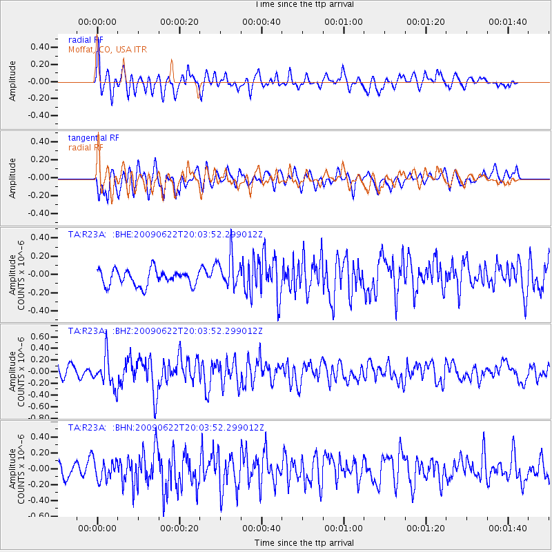
R23A Moffat, CO, USA - Earthquake Result Viewer
*The percent match for this event was below the threshold and hence no stack was calculated.
| Earthquake location: |
Andreanof Islands, Aleutian Is. |
| Earthquake latitude/longitude: |
51.3/-178.2 |
| Earthquake time(UTC): |
2009/06/22 (173) 19:55:24 GMT |
| Earthquake Depth: |
35 km |
| Earthquake Magnitude: |
5.6 MB, 5.6 MW, 5.6 MW |
| Earthquake Catalog/Contributor: |
WHDF/NEIC |
|
| Network: |
TA USArray Transportable Network (new EarthScope stations) |
| Station: |
R23A Moffat, CO, USA |
| Lat/Lon: |
38.19 N/105.83 W |
| Elevation: |
2547 m |
|
| Distance: |
51.0 deg |
| Az: |
75.01 deg |
| Baz: |
309.646 deg |
| Ray Param: |
$rayparam |
*The percent match for this event was below the threshold and hence was not used in the summary stack. |
|
| Radial Match: |
57.855896 % |
| Radial Bump: |
400 |
| Transverse Match: |
62.261158 % |
| Transverse Bump: |
400 |
| SOD ConfigId: |
2648 |
| Insert Time: |
2010-03-06 19:55:07.358 +0000 |
| GWidth: |
2.5 |
| Max Bumps: |
400 |
| Tol: |
0.001 |
|
Signal To Noise
| Channel | StoN | STA | LTA |
| TA:R23A: :BHZ:20090622T20:03:52.299012Z | 3.2612574 | 2.7374728E-7 | 8.393918E-8 |
| TA:R23A: :BHN:20090622T20:03:52.299012Z | 1.1215236 | 1.1673715E-7 | 1.04088E-7 |
| TA:R23A: :BHE:20090622T20:03:52.299012Z | 2.0982177 | 1.779385E-7 | 8.480459E-8 |
| Arrivals |
| Ps | |
| PpPs | |
| PsPs/PpSs | |


