You are here: Home > Network List > TA - USArray Transportable Network (new EarthScope stations) Stations List
> Station R23A Moffat, CO, USA > Earthquake Result Viewer
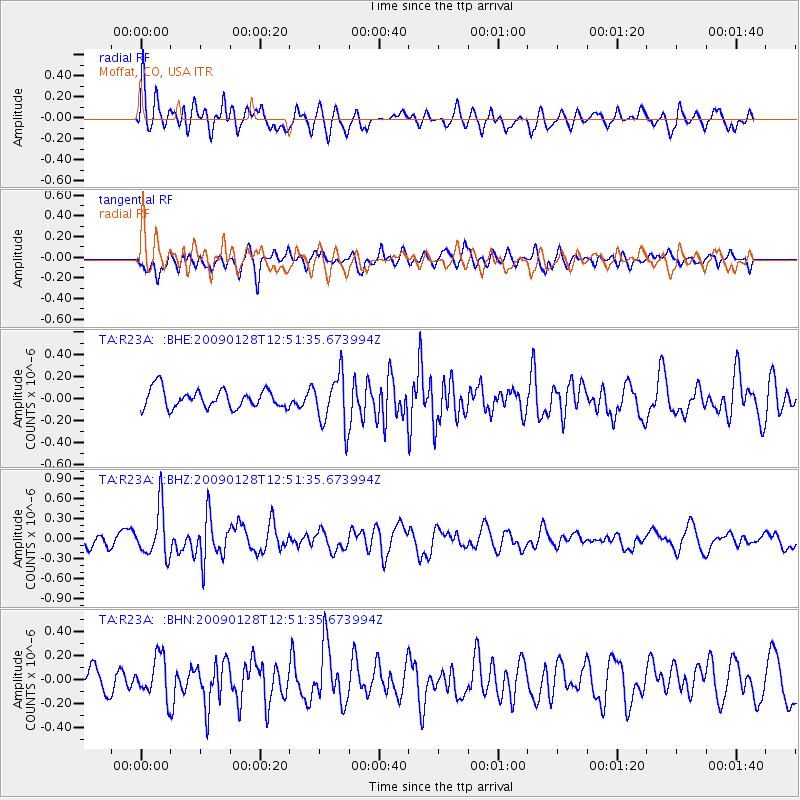
R23A Moffat, CO, USA - Earthquake Result Viewer
*The percent match for this event was below the threshold and hence no stack was calculated.
| Earthquake location: |
Samoa Islands Region |
| Earthquake latitude/longitude: |
-17.0/-172.1 |
| Earthquake time(UTC): |
2009/01/28 (028) 12:39:42 GMT |
| Earthquake Depth: |
10 km |
| Earthquake Magnitude: |
5.6 MB, 5.3 MS, 5.5 MW |
| Earthquake Catalog/Contributor: |
WHDF/NEIC |
|
| Network: |
TA USArray Transportable Network (new EarthScope stations) |
| Station: |
R23A Moffat, CO, USA |
| Lat/Lon: |
38.19 N/105.83 W |
| Elevation: |
2547 m |
|
| Distance: |
82.8 deg |
| Az: |
46.628 deg |
| Baz: |
241.985 deg |
| Ray Param: |
$rayparam |
*The percent match for this event was below the threshold and hence was not used in the summary stack. |
|
| Radial Match: |
70.09615 % |
| Radial Bump: |
400 |
| Transverse Match: |
53.453743 % |
| Transverse Bump: |
400 |
| SOD ConfigId: |
2658 |
| Insert Time: |
2010-03-06 19:55:17.689 +0000 |
| GWidth: |
2.5 |
| Max Bumps: |
400 |
| Tol: |
0.001 |
|
Signal To Noise
| Channel | StoN | STA | LTA |
| TA:R23A: :BHZ:20090128T12:51:35.673994Z | 2.5944936 | 3.6378148E-7 | 1.402129E-7 |
| TA:R23A: :BHN:20090128T12:51:35.673994Z | 1.657087 | 1.6972402E-7 | 1.02423115E-7 |
| TA:R23A: :BHE:20090128T12:51:35.673994Z | 2.7717519 | 2.3380632E-7 | 8.435326E-8 |
| Arrivals |
| Ps | |
| PpPs | |
| PsPs/PpSs | |


