You are here: Home > Network List > TA - USArray Transportable Network (new EarthScope stations) Stations List
> Station R23A Moffat, CO, USA > Earthquake Result Viewer
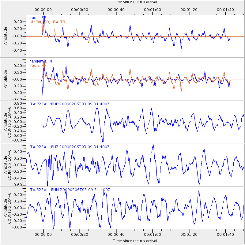
R23A Moffat, CO, USA - Earthquake Result Viewer
*The percent match for this event was below the threshold and hence no stack was calculated.
| Earthquake location: |
Near Coast Of Northern Chile |
| Earthquake latitude/longitude: |
-28.0/-71.1 |
| Earthquake time(UTC): |
2009/02/06 (037) 02:58:35 GMT |
| Earthquake Depth: |
52 km |
| Earthquake Magnitude: |
5.5 MB |
| Earthquake Catalog/Contributor: |
WHDF/NEIC |
|
| Network: |
TA USArray Transportable Network (new EarthScope stations) |
| Station: |
R23A Moffat, CO, USA |
| Lat/Lon: |
38.19 N/105.83 W |
| Elevation: |
2547 m |
|
| Distance: |
73.4 deg |
| Az: |
332.076 deg |
| Baz: |
148.293 deg |
| Ray Param: |
$rayparam |
*The percent match for this event was below the threshold and hence was not used in the summary stack. |
|
| Radial Match: |
63.48409 % |
| Radial Bump: |
400 |
| Transverse Match: |
61.134842 % |
| Transverse Bump: |
400 |
| SOD ConfigId: |
2658 |
| Insert Time: |
2010-03-06 19:55:20.489 +0000 |
| GWidth: |
2.5 |
| Max Bumps: |
400 |
| Tol: |
0.001 |
|
Signal To Noise
| Channel | StoN | STA | LTA |
| TA:R23A: :BHZ:20090206T03:09:31.400Z | 1.0579317 | 2.2388043E-7 | 2.1162089E-7 |
| TA:R23A: :BHN:20090206T03:09:31.400Z | 1.2639254 | 2.71932E-7 | 2.1514877E-7 |
| TA:R23A: :BHE:20090206T03:09:31.400Z | 2.4342785 | 5.1188266E-7 | 2.1028104E-7 |
| Arrivals |
| Ps | |
| PpPs | |
| PsPs/PpSs | |


