You are here: Home > Network List > TA - USArray Transportable Network (new EarthScope stations) Stations List
> Station R23A Moffat, CO, USA > Earthquake Result Viewer
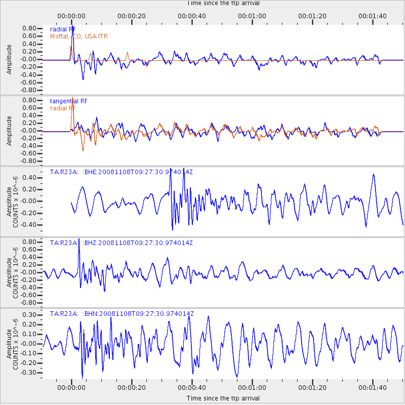
R23A Moffat, CO, USA - Earthquake Result Viewer
*The percent match for this event was below the threshold and hence no stack was calculated.
| Earthquake location: |
Tonga Islands |
| Earthquake latitude/longitude: |
-15.2/-174.2 |
| Earthquake time(UTC): |
2008/11/08 (313) 09:15:51 GMT |
| Earthquake Depth: |
140 km |
| Earthquake Magnitude: |
5.5 MW, 5.3 MB |
| Earthquake Catalog/Contributor: |
WHDF/NEIC |
|
| Network: |
TA USArray Transportable Network (new EarthScope stations) |
| Station: |
R23A Moffat, CO, USA |
| Lat/Lon: |
38.19 N/105.83 W |
| Elevation: |
2547 m |
|
| Distance: |
83.1 deg |
| Az: |
47.549 deg |
| Baz: |
244.686 deg |
| Ray Param: |
$rayparam |
*The percent match for this event was below the threshold and hence was not used in the summary stack. |
|
| Radial Match: |
66.808655 % |
| Radial Bump: |
400 |
| Transverse Match: |
71.53523 % |
| Transverse Bump: |
400 |
| SOD ConfigId: |
2658 |
| Insert Time: |
2010-03-06 19:55:24.418 +0000 |
| GWidth: |
2.5 |
| Max Bumps: |
400 |
| Tol: |
0.001 |
|
Signal To Noise
| Channel | StoN | STA | LTA |
| TA:R23A: :BHZ:20081108T09:27:30.974014Z | 2.8116148 | 2.362794E-7 | 8.4036905E-8 |
| TA:R23A: :BHN:20081108T09:27:30.974014Z | 1.3786253 | 1.3514024E-7 | 9.802536E-8 |
| TA:R23A: :BHE:20081108T09:27:30.974014Z | 2.0087478 | 2.2672758E-7 | 1.12870104E-7 |
| Arrivals |
| Ps | |
| PpPs | |
| PsPs/PpSs | |


