You are here: Home > Network List > TA - USArray Transportable Network (new EarthScope stations) Stations List
> Station R23A Moffat, CO, USA > Earthquake Result Viewer
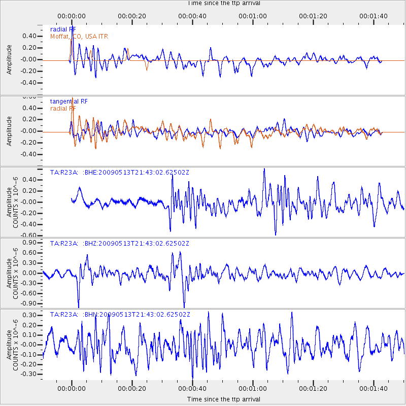
R23A Moffat, CO, USA - Earthquake Result Viewer
*The percent match for this event was below the threshold and hence no stack was calculated.
| Earthquake location: |
Tonga Islands |
| Earthquake latitude/longitude: |
-15.8/-173.5 |
| Earthquake time(UTC): |
2009/05/13 (133) 21:31:17 GMT |
| Earthquake Depth: |
85 km |
| Earthquake Magnitude: |
5.8 MW, 5.3 MB, 5.8 MW |
| Earthquake Catalog/Contributor: |
WHDF/NEIC |
|
| Network: |
TA USArray Transportable Network (new EarthScope stations) |
| Station: |
R23A Moffat, CO, USA |
| Lat/Lon: |
38.19 N/105.83 W |
| Elevation: |
2547 m |
|
| Distance: |
83.0 deg |
| Az: |
47.253 deg |
| Baz: |
243.82 deg |
| Ray Param: |
$rayparam |
*The percent match for this event was below the threshold and hence was not used in the summary stack. |
|
| Radial Match: |
72.36029 % |
| Radial Bump: |
400 |
| Transverse Match: |
51.745808 % |
| Transverse Bump: |
400 |
| SOD ConfigId: |
2760 |
| Insert Time: |
2010-03-06 19:55:26.738 +0000 |
| GWidth: |
2.5 |
| Max Bumps: |
400 |
| Tol: |
0.001 |
|
Signal To Noise
| Channel | StoN | STA | LTA |
| TA:R23A: :BHZ:20090513T21:43:02.62502Z | 4.617659 | 3.083949E-7 | 6.678599E-8 |
| TA:R23A: :BHN:20090513T21:43:02.62502Z | 1.2882327 | 1.1790012E-7 | 9.152083E-8 |
| TA:R23A: :BHE:20090513T21:43:02.62502Z | 2.8891187 | 1.9865595E-7 | 6.876005E-8 |
| Arrivals |
| Ps | |
| PpPs | |
| PsPs/PpSs | |


