You are here: Home > Network List > TA - USArray Transportable Network (new EarthScope stations) Stations List
> Station E18K Tukpahlearik Creek, AK, USA > Earthquake Result Viewer
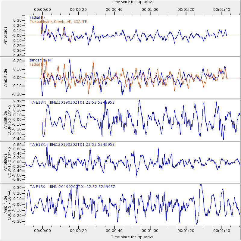
E18K Tukpahlearik Creek, AK, USA - Earthquake Result Viewer
*The percent match for this event was below the threshold and hence no stack was calculated.
| Earthquake location: |
Northern Molucca Sea |
| Earthquake latitude/longitude: |
0.4/125.4 |
| Earthquake time(UTC): |
2019/02/02 (033) 01:10:59 GMT |
| Earthquake Depth: |
37 km |
| Earthquake Magnitude: |
5.2 Mww |
| Earthquake Catalog/Contributor: |
NEIC PDE/us |
|
| Network: |
TA USArray Transportable Network (new EarthScope stations) |
| Station: |
E18K Tukpahlearik Creek, AK, USA |
| Lat/Lon: |
67.42 N/160.60 W |
| Elevation: |
297 m |
|
| Distance: |
83.5 deg |
| Az: |
21.94 deg |
| Baz: |
255.366 deg |
| Ray Param: |
$rayparam |
*The percent match for this event was below the threshold and hence was not used in the summary stack. |
|
| Radial Match: |
47.855152 % |
| Radial Bump: |
400 |
| Transverse Match: |
45.47098 % |
| Transverse Bump: |
400 |
| SOD ConfigId: |
13570011 |
| Insert Time: |
2019-05-02 11:22:45.290 +0000 |
| GWidth: |
2.5 |
| Max Bumps: |
400 |
| Tol: |
0.001 |
|
Signal To Noise
| Channel | StoN | STA | LTA |
| TA:E18K: :BHZ:20190202T01:22:52.524995Z | 2.2909105 | 2.5665108E-7 | 1.1203016E-7 |
| TA:E18K: :BHN:20190202T01:22:52.524995Z | 0.6894065 | 8.4867885E-8 | 1.2310282E-7 |
| TA:E18K: :BHE:20190202T01:22:52.524995Z | 0.88430566 | 1.36454E-7 | 1.5430638E-7 |
| Arrivals |
| Ps | |
| PpPs | |
| PsPs/PpSs | |


