You are here: Home > Network List > TA - USArray Transportable Network (new EarthScope stations) Stations List
> Station H16K Elim, AK, USA > Earthquake Result Viewer
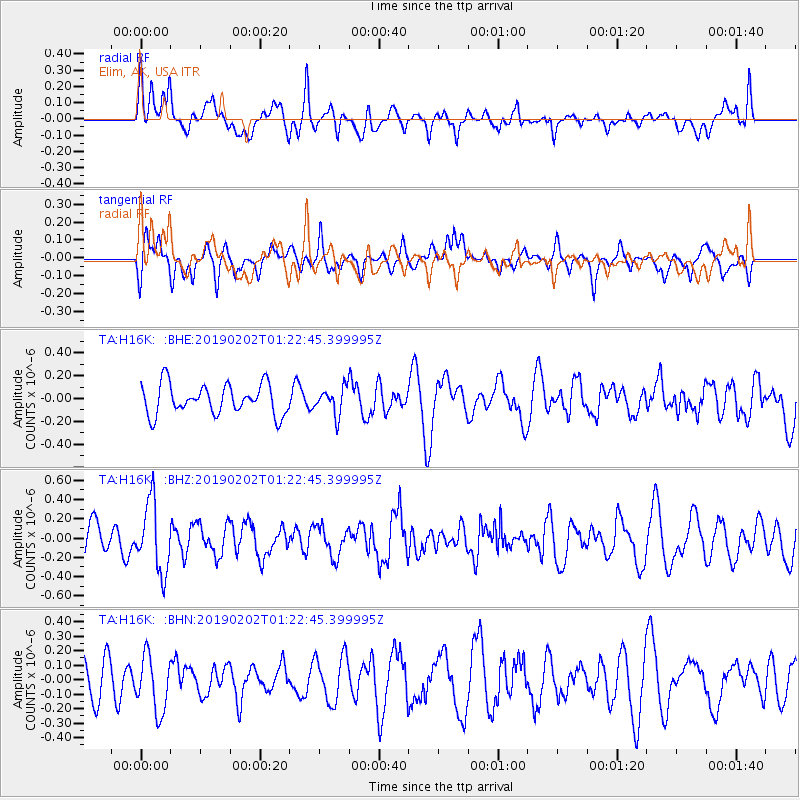
H16K Elim, AK, USA - Earthquake Result Viewer
*The percent match for this event was below the threshold and hence no stack was calculated.
| Earthquake location: |
Northern Molucca Sea |
| Earthquake latitude/longitude: |
0.4/125.4 |
| Earthquake time(UTC): |
2019/02/02 (033) 01:10:59 GMT |
| Earthquake Depth: |
37 km |
| Earthquake Magnitude: |
5.2 Mww |
| Earthquake Catalog/Contributor: |
NEIC PDE/us |
|
| Network: |
TA USArray Transportable Network (new EarthScope stations) |
| Station: |
H16K Elim, AK, USA |
| Lat/Lon: |
64.64 N/162.24 W |
| Elevation: |
216 m |
|
| Distance: |
82.2 deg |
| Az: |
24.482 deg |
| Baz: |
254.189 deg |
| Ray Param: |
$rayparam |
*The percent match for this event was below the threshold and hence was not used in the summary stack. |
|
| Radial Match: |
45.752438 % |
| Radial Bump: |
400 |
| Transverse Match: |
59.47105 % |
| Transverse Bump: |
386 |
| SOD ConfigId: |
13570011 |
| Insert Time: |
2019-05-02 11:22:52.040 +0000 |
| GWidth: |
2.5 |
| Max Bumps: |
400 |
| Tol: |
0.001 |
|
Signal To Noise
| Channel | StoN | STA | LTA |
| TA:H16K: :BHZ:20190202T01:22:45.399995Z | 2.1721354 | 3.6231137E-7 | 1.6679964E-7 |
| TA:H16K: :BHN:20190202T01:22:45.399995Z | 1.0265433 | 1.9174378E-7 | 1.8678588E-7 |
| TA:H16K: :BHE:20190202T01:22:45.399995Z | 0.9045635 | 1.1863247E-7 | 1.3114885E-7 |
| Arrivals |
| Ps | |
| PpPs | |
| PsPs/PpSs | |


