You are here: Home > Network List > TA - USArray Transportable Network (new EarthScope stations) Stations List
> Station Q24A Divide, CO, USA > Earthquake Result Viewer
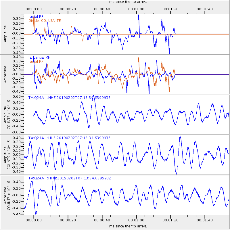
Q24A Divide, CO, USA - Earthquake Result Viewer
*The percent match for this event was below the threshold and hence no stack was calculated.
| Earthquake location: |
Tonga Islands |
| Earthquake latitude/longitude: |
-15.7/-174.9 |
| Earthquake time(UTC): |
2019/02/02 (033) 07:02:00 GMT |
| Earthquake Depth: |
260 km |
| Earthquake Magnitude: |
5.4 mww |
| Earthquake Catalog/Contributor: |
NEIC PDE/us |
|
| Network: |
TA USArray Transportable Network (new EarthScope stations) |
| Station: |
Q24A Divide, CO, USA |
| Lat/Lon: |
38.96 N/105.15 W |
| Elevation: |
2775 m |
|
| Distance: |
84.7 deg |
| Az: |
47.257 deg |
| Baz: |
245.161 deg |
| Ray Param: |
$rayparam |
*The percent match for this event was below the threshold and hence was not used in the summary stack. |
|
| Radial Match: |
64.803604 % |
| Radial Bump: |
400 |
| Transverse Match: |
55.87264 % |
| Transverse Bump: |
400 |
| SOD ConfigId: |
13570011 |
| Insert Time: |
2019-05-02 11:30:05.726 +0000 |
| GWidth: |
2.5 |
| Max Bumps: |
400 |
| Tol: |
0.001 |
|
Signal To Noise
| Channel | StoN | STA | LTA |
| TA:Q24A: :HHZ:20190202T07:13:34.639993Z | 1.0272021 | 1.5632817E-7 | 1.5218833E-7 |
| TA:Q24A: :HHN:20190202T07:13:34.639993Z | 0.9320765 | 3.178296E-7 | 3.4099088E-7 |
| TA:Q24A: :HHE:20190202T07:13:34.639993Z | 2.2580254 | 2.919621E-7 | 1.2929975E-7 |
| Arrivals |
| Ps | |
| PpPs | |
| PsPs/PpSs | |


