You are here: Home > Network List > TA - USArray Transportable Network (new EarthScope stations) Stations List
> Station F22A Rosebud, MT, USA > Earthquake Result Viewer
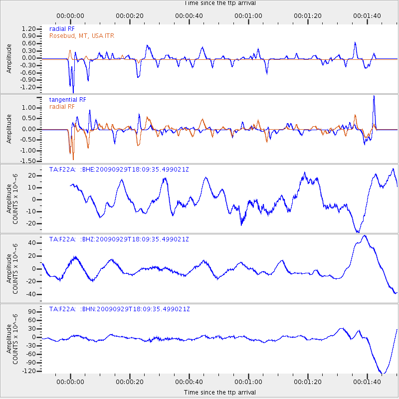
F22A Rosebud, MT, USA - Earthquake Result Viewer
*The percent match for this event was below the threshold and hence no stack was calculated.
| Earthquake location: |
Tonga Islands |
| Earthquake latitude/longitude: |
-15.8/-173.1 |
| Earthquake time(UTC): |
2009/09/29 (272) 17:57:26 GMT |
| Earthquake Depth: |
10 km |
| Earthquake Magnitude: |
5.6 MB |
| Earthquake Catalog/Contributor: |
WHDF/NEIC |
|
| Network: |
TA USArray Transportable Network (new EarthScope stations) |
| Station: |
F22A Rosebud, MT, USA |
| Lat/Lon: |
45.78 N/106.26 W |
| Elevation: |
882 m |
|
| Distance: |
85.9 deg |
| Az: |
40.181 deg |
| Baz: |
242.558 deg |
| Ray Param: |
$rayparam |
*The percent match for this event was below the threshold and hence was not used in the summary stack. |
|
| Radial Match: |
81.54352 % |
| Radial Bump: |
400 |
| Transverse Match: |
65.50005 % |
| Transverse Bump: |
400 |
| SOD ConfigId: |
2622 |
| Insert Time: |
2010-03-06 19:56:25.045 +0000 |
| GWidth: |
2.5 |
| Max Bumps: |
400 |
| Tol: |
0.001 |
|
Signal To Noise
| Channel | StoN | STA | LTA |
| TA:F22A: :BHZ:20090929T18:09:35.499021Z | 1.6641549 | 1.29285445E-5 | 7.768835E-6 |
| TA:F22A: :BHN:20090929T18:09:35.499021Z | 1.1726117 | 6.3742214E-6 | 5.4359184E-6 |
| TA:F22A: :BHE:20090929T18:09:35.499021Z | 1.3056238 | 1.1207692E-5 | 8.584167E-6 |
| Arrivals |
| Ps | |
| PpPs | |
| PsPs/PpSs | |


