You are here: Home > Network List > TA - USArray Transportable Network (new EarthScope stations) Stations List
> Station F22A Rosebud, MT, USA > Earthquake Result Viewer
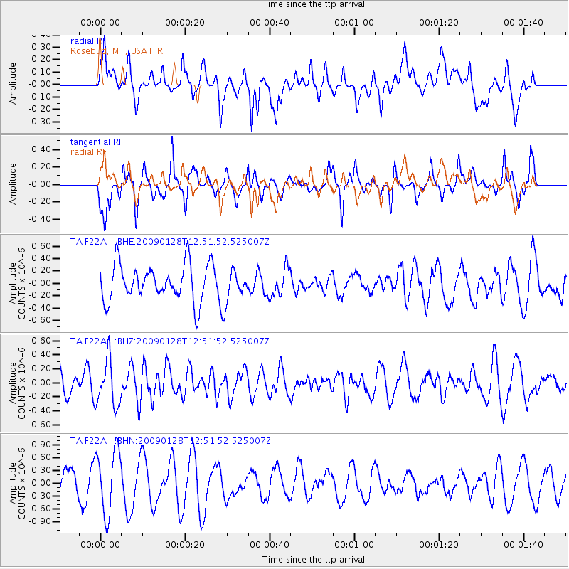
F22A Rosebud, MT, USA - Earthquake Result Viewer
*The percent match for this event was below the threshold and hence no stack was calculated.
| Earthquake location: |
Samoa Islands Region |
| Earthquake latitude/longitude: |
-17.0/-172.1 |
| Earthquake time(UTC): |
2009/01/28 (028) 12:39:42 GMT |
| Earthquake Depth: |
10 km |
| Earthquake Magnitude: |
5.6 MB, 5.3 MS, 5.5 MW |
| Earthquake Catalog/Contributor: |
WHDF/NEIC |
|
| Network: |
TA USArray Transportable Network (new EarthScope stations) |
| Station: |
F22A Rosebud, MT, USA |
| Lat/Lon: |
45.78 N/106.26 W |
| Elevation: |
882 m |
|
| Distance: |
86.1 deg |
| Az: |
39.779 deg |
| Baz: |
241.038 deg |
| Ray Param: |
$rayparam |
*The percent match for this event was below the threshold and hence was not used in the summary stack. |
|
| Radial Match: |
49.1609 % |
| Radial Bump: |
400 |
| Transverse Match: |
62.921013 % |
| Transverse Bump: |
374 |
| SOD ConfigId: |
2658 |
| Insert Time: |
2010-03-06 19:56:54.477 +0000 |
| GWidth: |
2.5 |
| Max Bumps: |
400 |
| Tol: |
0.001 |
|
Signal To Noise
| Channel | StoN | STA | LTA |
| TA:F22A: :BHZ:20090128T12:51:52.525007Z | 1.356981 | 3.2837164E-7 | 2.419869E-7 |
| TA:F22A: :BHN:20090128T12:51:52.525007Z | 2.264196 | 7.597862E-7 | 3.3556557E-7 |
| TA:F22A: :BHE:20090128T12:51:52.525007Z | 0.87673855 | 2.5305772E-7 | 2.8863533E-7 |
| Arrivals |
| Ps | |
| PpPs | |
| PsPs/PpSs | |


