You are here: Home > Network List > US - United States National Seismic Network Stations List
> Station EGMT Eagleton, Montana, USA > Earthquake Result Viewer
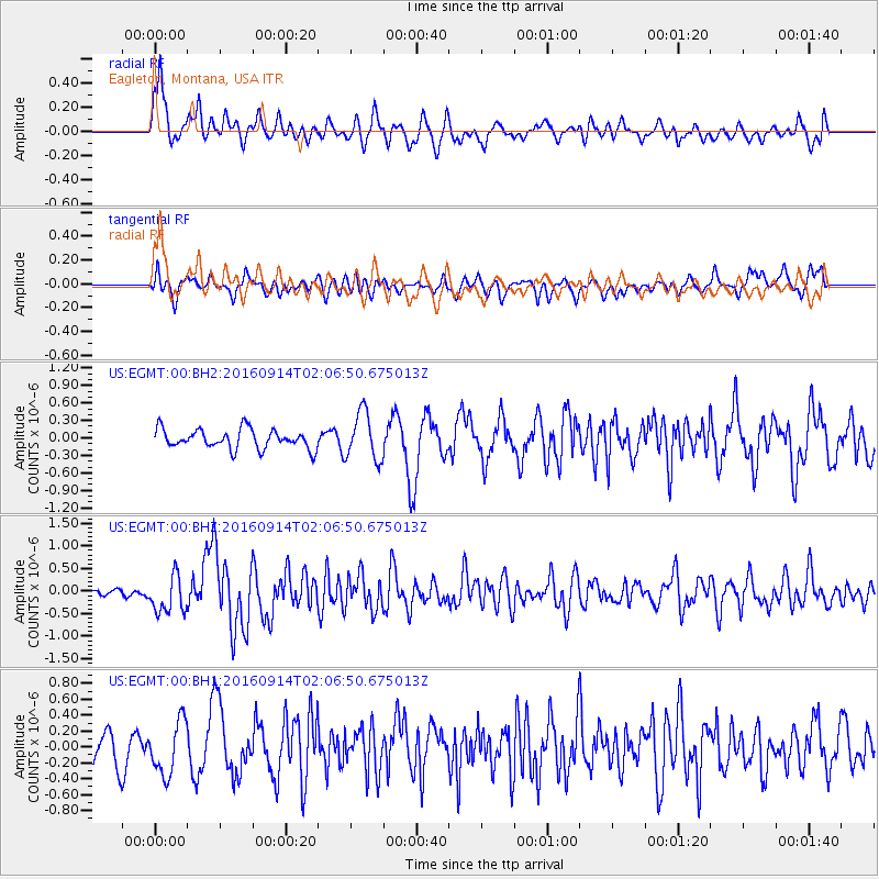
EGMT Eagleton, Montana, USA - Earthquake Result Viewer
*The percent match for this event was below the threshold and hence no stack was calculated.
| Earthquake location: |
Northern Colombia |
| Earthquake latitude/longitude: |
7.3/-76.1 |
| Earthquake time(UTC): |
2016/09/14 (258) 01:58:30 GMT |
| Earthquake Depth: |
10 km |
| Earthquake Magnitude: |
5.9 MWP |
| Earthquake Catalog/Contributor: |
NEIC PDE/NEIC COMCAT |
|
| Network: |
US United States National Seismic Network |
| Station: |
EGMT Eagleton, Montana, USA |
| Lat/Lon: |
48.02 N/109.75 W |
| Elevation: |
1055 m |
|
| Distance: |
49.6 deg |
| Az: |
330.754 deg |
| Baz: |
133.788 deg |
| Ray Param: |
$rayparam |
*The percent match for this event was below the threshold and hence was not used in the summary stack. |
|
| Radial Match: |
70.17148 % |
| Radial Bump: |
400 |
| Transverse Match: |
51.432762 % |
| Transverse Bump: |
400 |
| SOD ConfigId: |
1634031 |
| Insert Time: |
2016-09-28 02:02:09.815 +0000 |
| GWidth: |
2.5 |
| Max Bumps: |
400 |
| Tol: |
0.001 |
|
Signal To Noise
| Channel | StoN | STA | LTA |
| US:EGMT:00:BHZ:20160914T02:06:50.675013Z | 5.287735 | 4.1234034E-7 | 7.798052E-8 |
| US:EGMT:00:BH1:20160914T02:06:50.675013Z | 1.7100286 | 3.3495377E-7 | 1.9587611E-7 |
| US:EGMT:00:BH2:20160914T02:06:50.675013Z | 2.454073 | 4.0650377E-7 | 1.6564454E-7 |
| Arrivals |
| Ps | |
| PpPs | |
| PsPs/PpSs | |


