You are here: Home > Network List > US - United States National Seismic Network Stations List
> Station HAWA Hanford, Washington, USA > Earthquake Result Viewer
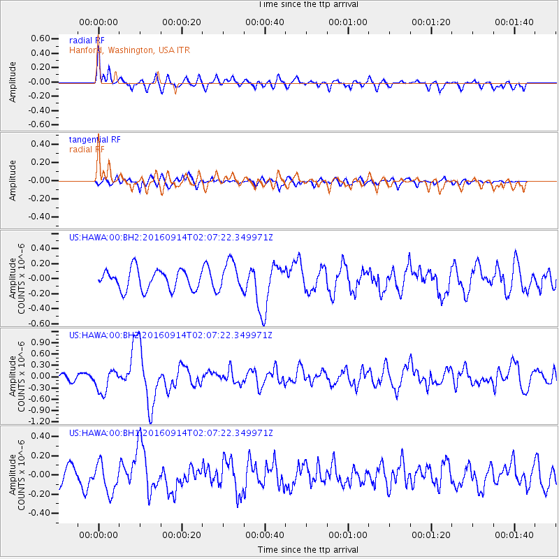
HAWA Hanford, Washington, USA - Earthquake Result Viewer
*The percent match for this event was below the threshold and hence no stack was calculated.
| Earthquake location: |
Northern Colombia |
| Earthquake latitude/longitude: |
7.3/-76.1 |
| Earthquake time(UTC): |
2016/09/14 (258) 01:58:30 GMT |
| Earthquake Depth: |
10 km |
| Earthquake Magnitude: |
5.9 MWP |
| Earthquake Catalog/Contributor: |
NEIC PDE/NEIC COMCAT |
|
| Network: |
US United States National Seismic Network |
| Station: |
HAWA Hanford, Washington, USA |
| Lat/Lon: |
46.39 N/119.53 W |
| Elevation: |
364 m |
|
| Distance: |
53.8 deg |
| Az: |
323.888 deg |
| Baz: |
122.366 deg |
| Ray Param: |
$rayparam |
*The percent match for this event was below the threshold and hence was not used in the summary stack. |
|
| Radial Match: |
57.622986 % |
| Radial Bump: |
400 |
| Transverse Match: |
57.589733 % |
| Transverse Bump: |
400 |
| SOD ConfigId: |
1634031 |
| Insert Time: |
2016-09-28 02:02:17.709 +0000 |
| GWidth: |
2.5 |
| Max Bumps: |
400 |
| Tol: |
0.001 |
|
Signal To Noise
| Channel | StoN | STA | LTA |
| US:HAWA:00:BHZ:20160914T02:07:22.349971Z | 2.218329 | 3.0937187E-7 | 1.3946168E-7 |
| US:HAWA:00:BH1:20160914T02:07:22.349971Z | 1.6937882 | 1.6027867E-7 | 9.4627346E-8 |
| US:HAWA:00:BH2:20160914T02:07:22.349971Z | 1.4766499 | 1.9493156E-7 | 1.3200933E-7 |
| Arrivals |
| Ps | |
| PpPs | |
| PsPs/PpSs | |


