You are here: Home > Network List > TA - USArray Transportable Network (new EarthScope stations) Stations List
> Station E20K Nigu River, AK, USA > Earthquake Result Viewer
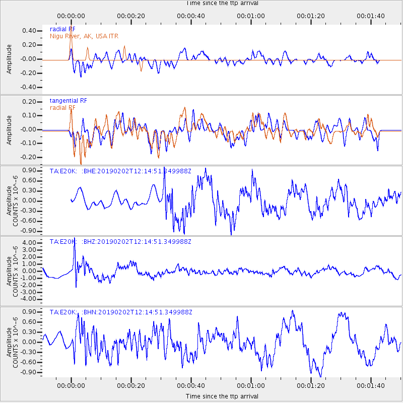
E20K Nigu River, AK, USA - Earthquake Result Viewer
*The percent match for this event was below the threshold and hence no stack was calculated.
| Earthquake location: |
Hindu Kush Region, Afghanistan |
| Earthquake latitude/longitude: |
36.5/70.7 |
| Earthquake time(UTC): |
2019/02/02 (033) 12:04:34 GMT |
| Earthquake Depth: |
211 km |
| Earthquake Magnitude: |
5.6 Mww |
| Earthquake Catalog/Contributor: |
NEIC PDE/us |
|
| Network: |
TA USArray Transportable Network (new EarthScope stations) |
| Station: |
E20K Nigu River, AK, USA |
| Lat/Lon: |
68.26 N/156.19 W |
| Elevation: |
866 m |
|
| Distance: |
69.9 deg |
| Az: |
16.839 deg |
| Baz: |
321.205 deg |
| Ray Param: |
$rayparam |
*The percent match for this event was below the threshold and hence was not used in the summary stack. |
|
| Radial Match: |
71.92949 % |
| Radial Bump: |
400 |
| Transverse Match: |
62.280228 % |
| Transverse Bump: |
400 |
| SOD ConfigId: |
13570011 |
| Insert Time: |
2019-05-02 11:46:58.088 +0000 |
| GWidth: |
2.5 |
| Max Bumps: |
400 |
| Tol: |
0.001 |
|
Signal To Noise
| Channel | StoN | STA | LTA |
| TA:E20K: :BHZ:20190202T12:14:51.349988Z | 3.236151 | 1.5016885E-6 | 4.6403537E-7 |
| TA:E20K: :BHN:20190202T12:14:51.349988Z | 1.0920131 | 4.477272E-7 | 4.1000166E-7 |
| TA:E20K: :BHE:20190202T12:14:51.349988Z | 2.524476 | 4.1041147E-7 | 1.6257293E-7 |
| Arrivals |
| Ps | |
| PpPs | |
| PsPs/PpSs | |


