You are here: Home > Network List > TA - USArray Transportable Network (new EarthScope stations) Stations List
> Station H16K Elim, AK, USA > Earthquake Result Viewer
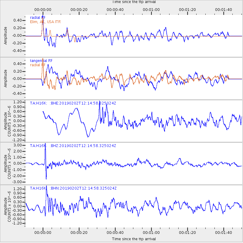
H16K Elim, AK, USA - Earthquake Result Viewer
*The percent match for this event was below the threshold and hence no stack was calculated.
| Earthquake location: |
Hindu Kush Region, Afghanistan |
| Earthquake latitude/longitude: |
36.5/70.7 |
| Earthquake time(UTC): |
2019/02/02 (033) 12:04:34 GMT |
| Earthquake Depth: |
211 km |
| Earthquake Magnitude: |
5.6 Mww |
| Earthquake Catalog/Contributor: |
NEIC PDE/us |
|
| Network: |
TA USArray Transportable Network (new EarthScope stations) |
| Station: |
H16K Elim, AK, USA |
| Lat/Lon: |
64.64 N/162.24 W |
| Elevation: |
216 m |
|
| Distance: |
71.0 deg |
| Az: |
21.311 deg |
| Baz: |
317.159 deg |
| Ray Param: |
$rayparam |
*The percent match for this event was below the threshold and hence was not used in the summary stack. |
|
| Radial Match: |
60.137905 % |
| Radial Bump: |
400 |
| Transverse Match: |
76.685326 % |
| Transverse Bump: |
400 |
| SOD ConfigId: |
13570011 |
| Insert Time: |
2019-05-02 11:47:19.522 +0000 |
| GWidth: |
2.5 |
| Max Bumps: |
400 |
| Tol: |
0.001 |
|
Signal To Noise
| Channel | StoN | STA | LTA |
| TA:H16K: :BHZ:20190202T12:14:58.325024Z | 4.5889597 | 1.009184E-6 | 2.1991562E-7 |
| TA:H16K: :BHN:20190202T12:14:58.325024Z | 2.2696335 | 5.554564E-7 | 2.4473394E-7 |
| TA:H16K: :BHE:20190202T12:14:58.325024Z | 0.9583818 | 4.4792955E-7 | 4.673811E-7 |
| Arrivals |
| Ps | |
| PpPs | |
| PsPs/PpSs | |


