You are here: Home > Network List > TS - TERRAscope (Southern California Seismic Network) Stations List
> Station CALB Calabasas, California, USA > Earthquake Result Viewer
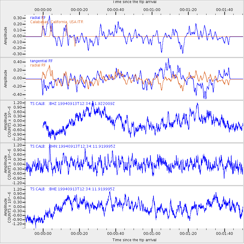
CALB Calabasas, California, USA - Earthquake Result Viewer
*The percent match for this event was below the threshold and hence no stack was calculated.
| Earthquake location: |
Southeast Of Loyalty Islands |
| Earthquake latitude/longitude: |
-22.3/174.7 |
| Earthquake time(UTC): |
1994/09/13 (256) 12:22:12 GMT |
| Earthquake Depth: |
33 km |
| Earthquake Magnitude: |
5.5 MB, 5.4 MS |
| Earthquake Catalog/Contributor: |
WHDF/NEIC |
|
| Network: |
TS TERRAscope (Southern California Seismic Network) |
| Station: |
CALB Calabasas, California, USA |
| Lat/Lon: |
34.14 N/118.63 W |
| Elevation: |
0.0 m |
|
| Distance: |
84.7 deg |
| Az: |
49.915 deg |
| Baz: |
238.696 deg |
| Ray Param: |
$rayparam |
*The percent match for this event was below the threshold and hence was not used in the summary stack. |
|
| Radial Match: |
31.456457 % |
| Radial Bump: |
310 |
| Transverse Match: |
54.557938 % |
| Transverse Bump: |
366 |
| SOD ConfigId: |
4480 |
| Insert Time: |
2010-02-26 14:05:07.388 +0000 |
| GWidth: |
2.5 |
| Max Bumps: |
400 |
| Tol: |
0.001 |
|
Signal To Noise
| Channel | StoN | STA | LTA |
| TS:CALB: :BHN:19940913T12:34:11.919995Z | 1.9472754 | 4.5246318E-7 | 2.3235707E-7 |
| TS:CALB: :BHE:19940913T12:34:11.919995Z | 1.3208994 | 7.0738724E-7 | 5.355346E-7 |
| TS:CALB: :BHZ:19940913T12:34:11.922009Z | 1.6728523 | 8.7966447E-7 | 5.2584704E-7 |
| Arrivals |
| Ps | |
| PpPs | |
| PsPs/PpSs | |


