
R26A Arlington, CO, USA - Earthquake Result Viewer
| ||||||||||||||||||
| ||||||||||||||||||
| ||||||||||||||||||
|
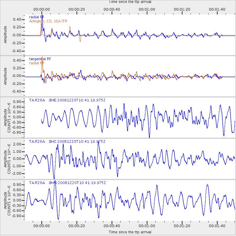
Signal To Noise
| Channel | StoN | STA | LTA |
| TA:R26A: :BHZ:20081220T10:41:19.975Z | 2.0268652 | 6.776327E-7 | 3.343255E-7 |
| TA:R26A: :BHN:20081220T10:41:19.975Z | 1.0568566 | 2.8765606E-7 | 2.7218078E-7 |
| TA:R26A: :BHE:20081220T10:41:19.975Z | 1.6096729 | 4.867742E-7 | 3.0240565E-7 |
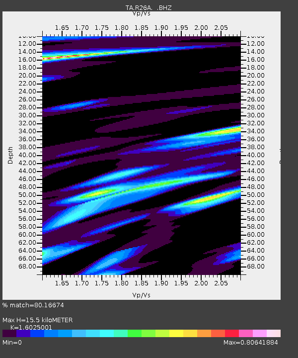
| Arrivals | |
| Ps | 1.5 SECOND |
| PpPs | 6.3 SECOND |
| PsPs/PpSs | 7.8 SECOND |

