You are here: Home > Network List > US - United States National Seismic Network Stations List
> Station WMOK Wichita Mountains, Oklahoma, USA > Earthquake Result Viewer
WMOK Wichita Mountains, Oklahoma, USA - Earthquake Result Viewer
*The percent match for this event was below the threshold and hence no stack was calculated.
| Earthquake location: |
Near Coast Of Ecuador |
| Earthquake latitude/longitude: |
-2.4/-79.9 |
| Earthquake time(UTC): |
2019/02/04 (035) 17:45:47 GMT |
| Earthquake Depth: |
70 km |
| Earthquake Magnitude: |
5.8 Mww |
| Earthquake Catalog/Contributor: |
NEIC PDE/us |
|
| Network: |
US United States National Seismic Network |
| Station: |
WMOK Wichita Mountains, Oklahoma, USA |
| Lat/Lon: |
34.74 N/98.78 W |
| Elevation: |
486 m |
|
| Distance: |
41.0 deg |
| Az: |
336.001 deg |
| Baz: |
150.435 deg |
| Ray Param: |
$rayparam |
*The percent match for this event was below the threshold and hence was not used in the summary stack. |
|
| Radial Match: |
70.038345 % |
| Radial Bump: |
400 |
| Transverse Match: |
46.948097 % |
| Transverse Bump: |
400 |
| SOD ConfigId: |
13570011 |
| Insert Time: |
2019-05-02 12:03:52.810 +0000 |
| GWidth: |
2.5 |
| Max Bumps: |
400 |
| Tol: |
0.001 |
|
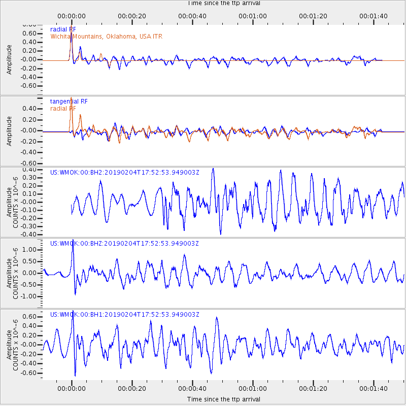
Signal To Noise
| Channel | StoN | STA | LTA |
| US:WMOK:00:BHZ:20190204T17:52:53.949003Z | 3.3573308 | 5.3078475E-7 | 1.5809725E-7 |
| US:WMOK:00:BH1:20190204T17:52:53.949003Z | 3.0066314 | 3.276003E-7 | 1.0895925E-7 |
| US:WMOK:00:BH2:20190204T17:52:53.949003Z | 1.5784823 | 1.6350498E-7 | 1.0358366E-7 |
| Arrivals |
| Ps | |
| PpPs | |
| PsPs/PpSs | |


