You are here: Home > Network List > TA - USArray Transportable Network (new EarthScope stations) Stations List
> Station R26A Arlington, CO, USA > Earthquake Result Viewer
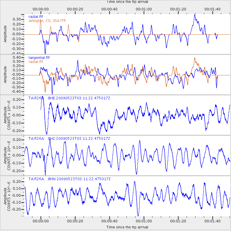
R26A Arlington, CO, USA - Earthquake Result Viewer
*The percent match for this event was below the threshold and hence no stack was calculated.
| Earthquake location: |
South Of Fiji Islands |
| Earthquake latitude/longitude: |
-24.4/178.8 |
| Earthquake time(UTC): |
2009/05/23 (143) 02:59:28 GMT |
| Earthquake Depth: |
566 km |
| Earthquake Magnitude: |
5.5 MW, 5.1 MB |
| Earthquake Catalog/Contributor: |
WHDF/NEIC |
|
| Network: |
TA USArray Transportable Network (new EarthScope stations) |
| Station: |
R26A Arlington, CO, USA |
| Lat/Lon: |
38.30 N/103.45 W |
| Elevation: |
1304 m |
|
| Distance: |
95.8 deg |
| Az: |
50.594 deg |
| Baz: |
243.572 deg |
| Ray Param: |
$rayparam |
*The percent match for this event was below the threshold and hence was not used in the summary stack. |
|
| Radial Match: |
40.2169 % |
| Radial Bump: |
400 |
| Transverse Match: |
56.915623 % |
| Transverse Bump: |
400 |
| SOD ConfigId: |
2648 |
| Insert Time: |
2010-03-06 20:00:19.322 +0000 |
| GWidth: |
2.5 |
| Max Bumps: |
400 |
| Tol: |
0.001 |
|
Signal To Noise
| Channel | StoN | STA | LTA |
| TA:R26A: :BHZ:20090523T03:11:22.475017Z | 1.0734247 | 8.4644135E-8 | 7.885428E-8 |
| TA:R26A: :BHN:20090523T03:11:22.475017Z | 0.974715 | 9.703128E-8 | 9.954836E-8 |
| TA:R26A: :BHE:20090523T03:11:22.475017Z | 1.3643495 | 1.2864692E-7 | 9.429177E-8 |
| Arrivals |
| Ps | |
| PpPs | |
| PsPs/PpSs | |


