You are here: Home > Network List > TA - USArray Transportable Network (new EarthScope stations) Stations List
> Station R26A Arlington, CO, USA > Earthquake Result Viewer
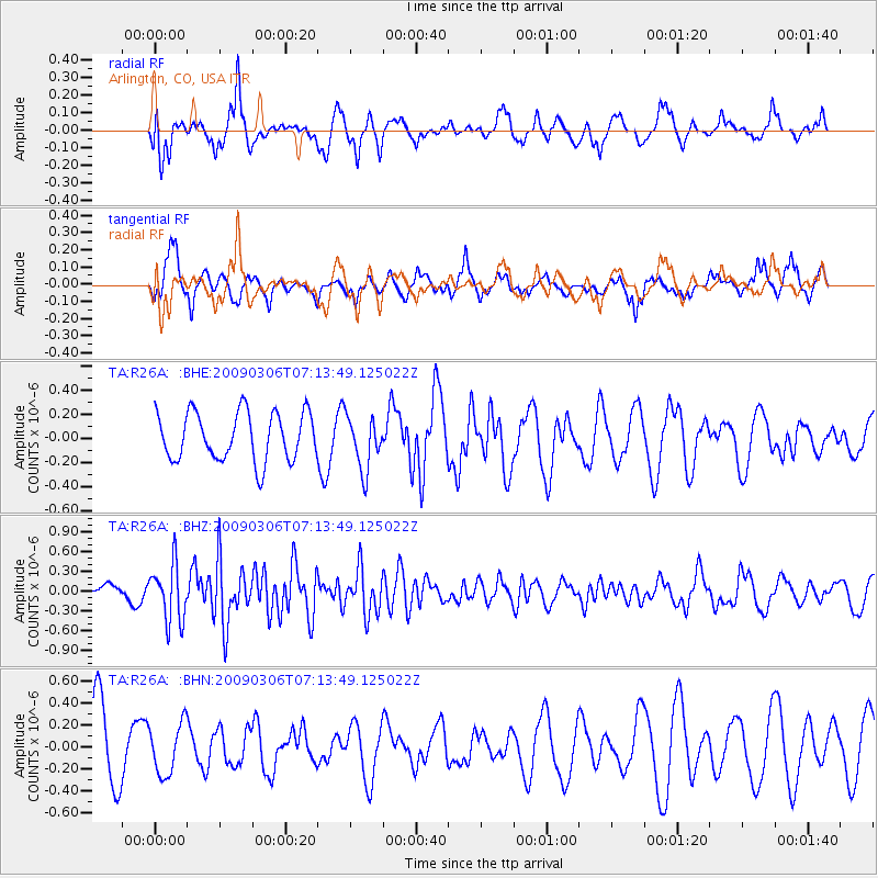
R26A Arlington, CO, USA - Earthquake Result Viewer
*The percent match for this event was below the threshold and hence no stack was calculated.
| Earthquake location: |
Tonga Islands |
| Earthquake latitude/longitude: |
-15.2/-173.3 |
| Earthquake time(UTC): |
2009/03/06 (065) 07:01:48 GMT |
| Earthquake Depth: |
3.0 km |
| Earthquake Magnitude: |
5.5 MB, 5.4 MS, 5.8 MW, 5.8 MW |
| Earthquake Catalog/Contributor: |
WHDF/NEIC |
|
| Network: |
TA USArray Transportable Network (new EarthScope stations) |
| Station: |
R26A Arlington, CO, USA |
| Lat/Lon: |
38.30 N/103.45 W |
| Elevation: |
1304 m |
|
| Distance: |
84.2 deg |
| Az: |
47.945 deg |
| Baz: |
245.686 deg |
| Ray Param: |
$rayparam |
*The percent match for this event was below the threshold and hence was not used in the summary stack. |
|
| Radial Match: |
63.206947 % |
| Radial Bump: |
400 |
| Transverse Match: |
40.98754 % |
| Transverse Bump: |
321 |
| SOD ConfigId: |
2658 |
| Insert Time: |
2010-03-06 20:00:25.550 +0000 |
| GWidth: |
2.5 |
| Max Bumps: |
400 |
| Tol: |
0.001 |
|
Signal To Noise
| Channel | StoN | STA | LTA |
| TA:R26A: :BHZ:20090306T07:13:49.125022Z | 1.9364289 | 4.3280212E-7 | 2.2350531E-7 |
| TA:R26A: :BHN:20090306T07:13:49.125022Z | 0.8484276 | 2.3040562E-7 | 2.715678E-7 |
| TA:R26A: :BHE:20090306T07:13:49.125022Z | 1.0939589 | 2.1744032E-7 | 1.9876462E-7 |
| Arrivals |
| Ps | |
| PpPs | |
| PsPs/PpSs | |


