You are here: Home > Network List > TA - USArray Transportable Network (new EarthScope stations) Stations List
> Station C16K Lisburne Hills, AK, USA > Earthquake Result Viewer
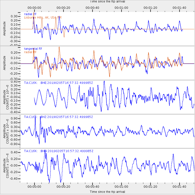
C16K Lisburne Hills, AK, USA - Earthquake Result Viewer
*The percent match for this event was below the threshold and hence no stack was calculated.
| Earthquake location: |
Northwestern Kashmir |
| Earthquake latitude/longitude: |
35.1/74.2 |
| Earthquake time(UTC): |
2019/02/05 (036) 16:47:08 GMT |
| Earthquake Depth: |
33 km |
| Earthquake Magnitude: |
5.3 Mww |
| Earthquake Catalog/Contributor: |
NEIC PDE/us |
|
| Network: |
TA USArray Transportable Network (new EarthScope stations) |
| Station: |
C16K Lisburne Hills, AK, USA |
| Lat/Lon: |
68.27 N/165.34 W |
| Elevation: |
102 m |
|
| Distance: |
67.9 deg |
| Az: |
20.258 deg |
| Baz: |
310.287 deg |
| Ray Param: |
$rayparam |
*The percent match for this event was below the threshold and hence was not used in the summary stack. |
|
| Radial Match: |
53.25291 % |
| Radial Bump: |
400 |
| Transverse Match: |
54.407238 % |
| Transverse Bump: |
400 |
| SOD ConfigId: |
13570011 |
| Insert Time: |
2019-05-02 12:13:41.928 +0000 |
| GWidth: |
2.5 |
| Max Bumps: |
400 |
| Tol: |
0.001 |
|
Signal To Noise
| Channel | StoN | STA | LTA |
| TA:C16K: :BHZ:20190205T16:57:32.499985Z | 4.297478 | 4.986749E-7 | 1.1603897E-7 |
| TA:C16K: :BHN:20190205T16:57:32.499985Z | 0.8262518 | 9.69368E-8 | 1.1732113E-7 |
| TA:C16K: :BHE:20190205T16:57:32.499985Z | 0.7710841 | 1.1911402E-7 | 1.5447606E-7 |
| Arrivals |
| Ps | |
| PpPs | |
| PsPs/PpSs | |


