You are here: Home > Network List > TA - USArray Transportable Network (new EarthScope stations) Stations List
> Station D23K Nanushuk River, AK USA > Earthquake Result Viewer
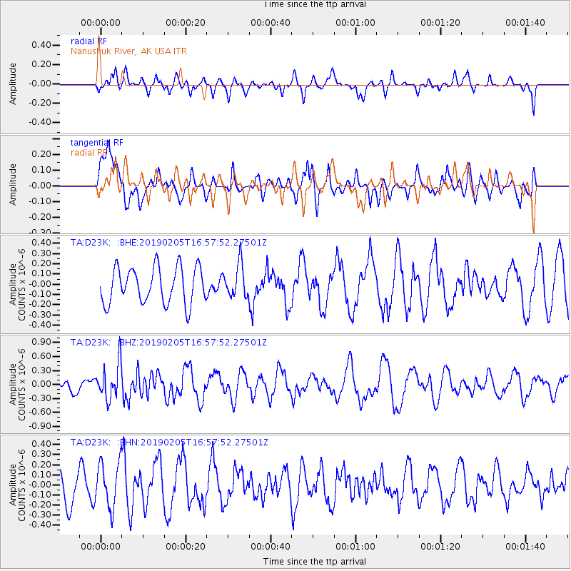
D23K Nanushuk River, AK USA - Earthquake Result Viewer
*The percent match for this event was below the threshold and hence no stack was calculated.
| Earthquake location: |
Northwestern Kashmir |
| Earthquake latitude/longitude: |
35.1/74.2 |
| Earthquake time(UTC): |
2019/02/05 (036) 16:47:08 GMT |
| Earthquake Depth: |
33 km |
| Earthquake Magnitude: |
5.3 Mww |
| Earthquake Catalog/Contributor: |
NEIC PDE/us |
|
| Network: |
TA USArray Transportable Network (new EarthScope stations) |
| Station: |
D23K Nanushuk River, AK USA |
| Lat/Lon: |
68.97 N/150.68 W |
| Elevation: |
406 m |
|
| Distance: |
71.1 deg |
| Az: |
15.611 deg |
| Baz: |
322.312 deg |
| Ray Param: |
$rayparam |
*The percent match for this event was below the threshold and hence was not used in the summary stack. |
|
| Radial Match: |
49.429222 % |
| Radial Bump: |
400 |
| Transverse Match: |
43.022034 % |
| Transverse Bump: |
400 |
| SOD ConfigId: |
13570011 |
| Insert Time: |
2019-05-02 12:13:49.384 +0000 |
| GWidth: |
2.5 |
| Max Bumps: |
400 |
| Tol: |
0.001 |
|
Signal To Noise
| Channel | StoN | STA | LTA |
| TA:D23K: :BHZ:20190205T16:57:52.27501Z | 2.0901759 | 3.8547466E-7 | 1.8442212E-7 |
| TA:D23K: :BHN:20190205T16:57:52.27501Z | 1.5194222 | 2.2939724E-7 | 1.5097663E-7 |
| TA:D23K: :BHE:20190205T16:57:52.27501Z | 0.94260687 | 1.6767302E-7 | 1.7788224E-7 |
| Arrivals |
| Ps | |
| PpPs | |
| PsPs/PpSs | |


