You are here: Home > Network List > TA - USArray Transportable Network (new EarthScope stations) Stations List
> Station H16K Elim, AK, USA > Earthquake Result Viewer
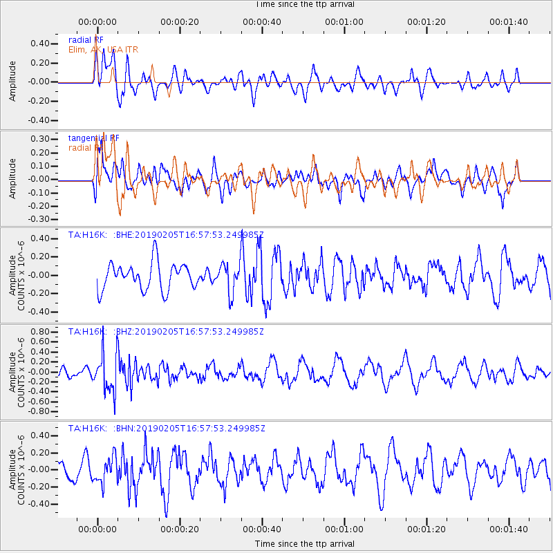
H16K Elim, AK, USA - Earthquake Result Viewer
*The percent match for this event was below the threshold and hence no stack was calculated.
| Earthquake location: |
Northwestern Kashmir |
| Earthquake latitude/longitude: |
35.1/74.2 |
| Earthquake time(UTC): |
2019/02/05 (036) 16:47:08 GMT |
| Earthquake Depth: |
33 km |
| Earthquake Magnitude: |
5.3 Mww |
| Earthquake Catalog/Contributor: |
NEIC PDE/us |
|
| Network: |
TA USArray Transportable Network (new EarthScope stations) |
| Station: |
H16K Elim, AK, USA |
| Lat/Lon: |
64.64 N/162.24 W |
| Elevation: |
216 m |
|
| Distance: |
71.3 deg |
| Az: |
22.259 deg |
| Baz: |
313.83 deg |
| Ray Param: |
$rayparam |
*The percent match for this event was below the threshold and hence was not used in the summary stack. |
|
| Radial Match: |
72.50335 % |
| Radial Bump: |
400 |
| Transverse Match: |
37.47666 % |
| Transverse Bump: |
400 |
| SOD ConfigId: |
13570011 |
| Insert Time: |
2019-05-02 12:14:09.627 +0000 |
| GWidth: |
2.5 |
| Max Bumps: |
400 |
| Tol: |
0.001 |
|
Signal To Noise
| Channel | StoN | STA | LTA |
| TA:H16K: :BHZ:20190205T16:57:53.249985Z | 4.471071 | 3.845459E-7 | 8.600757E-8 |
| TA:H16K: :BHN:20190205T16:57:53.249985Z | 1.2735388 | 1.484855E-7 | 1.1659284E-7 |
| TA:H16K: :BHE:20190205T16:57:53.249985Z | 1.3438619 | 1.936375E-7 | 1.4409032E-7 |
| Arrivals |
| Ps | |
| PpPs | |
| PsPs/PpSs | |


