You are here: Home > Network List > TA - USArray Transportable Network (new EarthScope stations) Stations List
> Station R26A Arlington, CO, USA > Earthquake Result Viewer
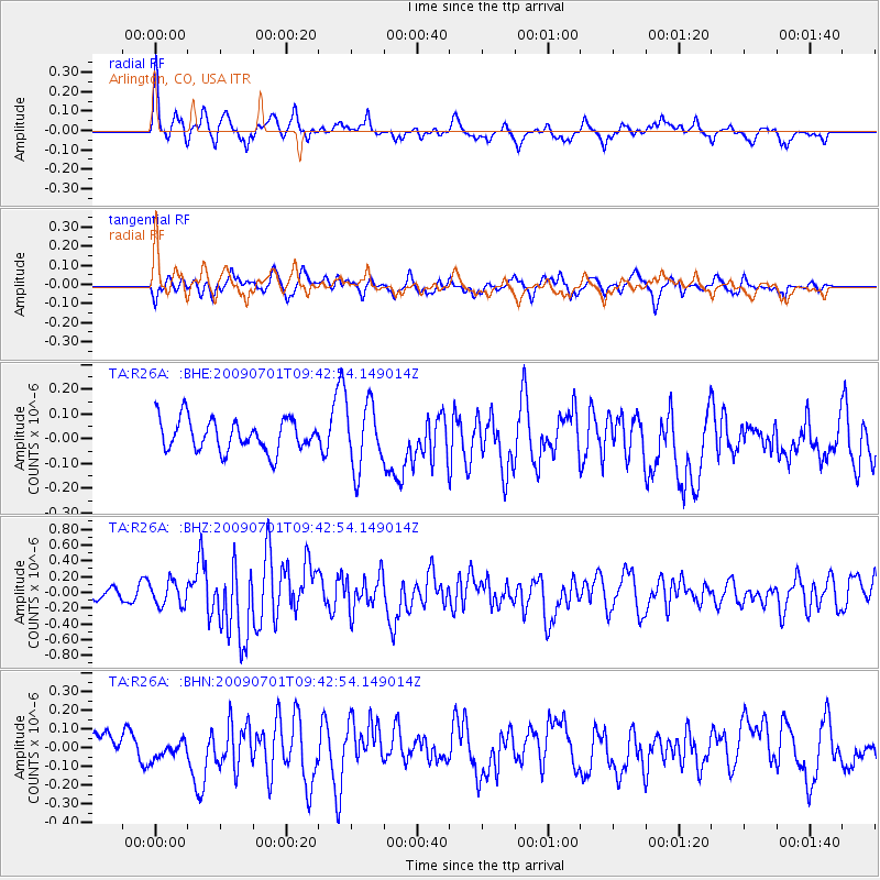
R26A Arlington, CO, USA - Earthquake Result Viewer
*The percent match for this event was below the threshold and hence no stack was calculated.
| Earthquake location: |
Crete, Greece |
| Earthquake latitude/longitude: |
34.2/25.5 |
| Earthquake time(UTC): |
2009/07/01 (182) 09:30:10 GMT |
| Earthquake Depth: |
19 km |
| Earthquake Magnitude: |
6.1 MB, 6.3 MS, 6.4 MW, 6.4 MW |
| Earthquake Catalog/Contributor: |
WHDF/NEIC |
|
| Network: |
TA USArray Transportable Network (new EarthScope stations) |
| Station: |
R26A Arlington, CO, USA |
| Lat/Lon: |
38.30 N/103.45 W |
| Elevation: |
1304 m |
|
| Distance: |
93.7 deg |
| Az: |
322.161 deg |
| Baz: |
40.278 deg |
| Ray Param: |
$rayparam |
*The percent match for this event was below the threshold and hence was not used in the summary stack. |
|
| Radial Match: |
64.93882 % |
| Radial Bump: |
400 |
| Transverse Match: |
59.75857 % |
| Transverse Bump: |
400 |
| SOD ConfigId: |
2648 |
| Insert Time: |
2010-03-06 20:00:45.375 +0000 |
| GWidth: |
2.5 |
| Max Bumps: |
400 |
| Tol: |
0.001 |
|
Signal To Noise
| Channel | StoN | STA | LTA |
| TA:R26A: :BHZ:20090701T09:42:54.149014Z | 2.6130083 | 1.5322216E-7 | 5.8638225E-8 |
| TA:R26A: :BHN:20090701T09:42:54.149014Z | 0.60701615 | 5.5916363E-8 | 9.211676E-8 |
| TA:R26A: :BHE:20090701T09:42:54.149014Z | 2.039897 | 1.2994938E-7 | 6.3703894E-8 |
| Arrivals |
| Ps | |
| PpPs | |
| PsPs/PpSs | |


