You are here: Home > Network List > TA - USArray Transportable Network (new EarthScope stations) Stations List
> Station J26L Joseph Creek, AK, USA > Earthquake Result Viewer
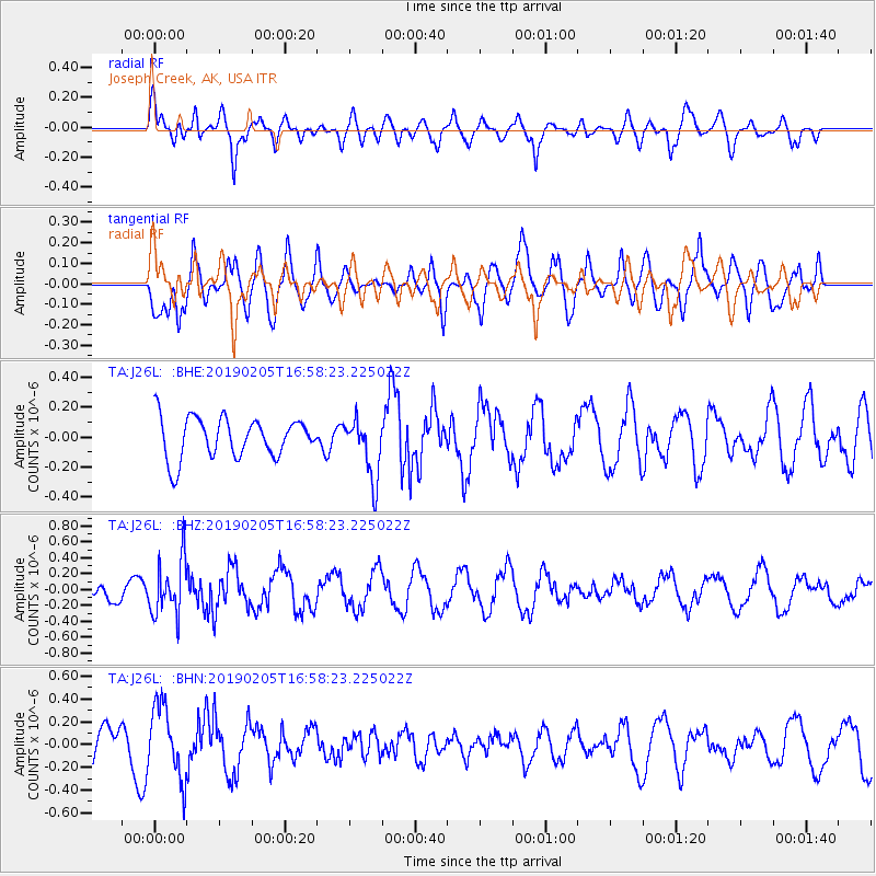
J26L Joseph Creek, AK, USA - Earthquake Result Viewer
*The percent match for this event was below the threshold and hence no stack was calculated.
| Earthquake location: |
Northwestern Kashmir |
| Earthquake latitude/longitude: |
35.1/74.2 |
| Earthquake time(UTC): |
2019/02/05 (036) 16:47:08 GMT |
| Earthquake Depth: |
33 km |
| Earthquake Magnitude: |
5.3 Mww |
| Earthquake Catalog/Contributor: |
NEIC PDE/us |
|
| Network: |
TA USArray Transportable Network (new EarthScope stations) |
| Station: |
J26L Joseph Creek, AK, USA |
| Lat/Lon: |
64.50 N/143.56 W |
| Elevation: |
1144 m |
|
| Distance: |
76.4 deg |
| Az: |
15.815 deg |
| Baz: |
328.907 deg |
| Ray Param: |
$rayparam |
*The percent match for this event was below the threshold and hence was not used in the summary stack. |
|
| Radial Match: |
60.699303 % |
| Radial Bump: |
400 |
| Transverse Match: |
57.511463 % |
| Transverse Bump: |
400 |
| SOD ConfigId: |
13570011 |
| Insert Time: |
2019-05-02 12:14:20.901 +0000 |
| GWidth: |
2.5 |
| Max Bumps: |
400 |
| Tol: |
0.001 |
|
Signal To Noise
| Channel | StoN | STA | LTA |
| TA:J26L: :BHZ:20190205T16:58:23.225022Z | 2.5185554 | 3.4606674E-7 | 1.3740684E-7 |
| TA:J26L: :BHN:20190205T16:58:23.225022Z | 2.0038526 | 3.1974625E-7 | 1.5956576E-7 |
| TA:J26L: :BHE:20190205T16:58:23.225022Z | 1.5020437 | 1.9789337E-7 | 1.317494E-7 |
| Arrivals |
| Ps | |
| PpPs | |
| PsPs/PpSs | |


