You are here: Home > Network List > UW - Pacific Northwest Regional Seismic Network Stations List
> Station YACT Amboy, WA, USA > Earthquake Result Viewer
YACT Amboy, WA, USA - Earthquake Result Viewer

| Earthquake location: |
Northwestern Kashmir |
| Earthquake latitude/longitude: |
35.1/74.2 |
| Earthquake time(UTC): |
2019/02/05 (036) 16:47:08 GMT |
| Earthquake Depth: |
33 km |
| Earthquake Magnitude: |
5.3 Mww |
| Earthquake Catalog/Contributor: |
NEIC PDE/us |
|
| Network: |
UW Pacific Northwest Regional Seismic Network |
| Station: |
YACT Amboy, WA, USA |
| Lat/Lon: |
45.93 N/122.42 W |
| Elevation: |
211 m |
|
| Distance: |
98.0 deg |
| Az: |
11.608 deg |
| Baz: |
346.321 deg |
| Ray Param: |
0.040027875 |
| Estimated Moho Depth: |
31.5 km |
| Estimated Crust Vp/Vs: |
1.74 |
| Assumed Crust Vp: |
6.566 km/s |
| Estimated Crust Vs: |
3.774 km/s |
| Estimated Crust Poisson's Ratio: |
0.25 |
|
| Radial Match: |
91.34175 % |
| Radial Bump: |
158 |
| Transverse Match: |
48.05635 % |
| Transverse Bump: |
400 |
| SOD ConfigId: |
13570011 |
| Insert Time: |
2019-05-02 12:15:02.271 +0000 |
| GWidth: |
2.5 |
| Max Bumps: |
400 |
| Tol: |
0.001 |
|
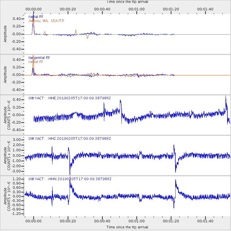
Signal To Noise
| Channel | StoN | STA | LTA |
| UW:YACT: :HHZ:20190205T17:00:09.387986Z | 0.90858835 | 2.6990122E-7 | 2.9705558E-7 |
| UW:YACT: :HHN:20190205T17:00:09.387986Z | 0.8863119 | 9.6756885E-8 | 1.09167985E-7 |
| UW:YACT: :HHE:20190205T17:00:09.387986Z | 0.6721225 | 4.0116145E-8 | 5.968577E-8 |
| Arrivals |
| Ps | 3.6 SECOND |
| PpPs | 13 SECOND |
| PsPs/PpSs | 17 SECOND |


