You are here: Home > Network List > TA - USArray Transportable Network (new EarthScope stations) Stations List
> Station R26A Arlington, CO, USA > Earthquake Result Viewer
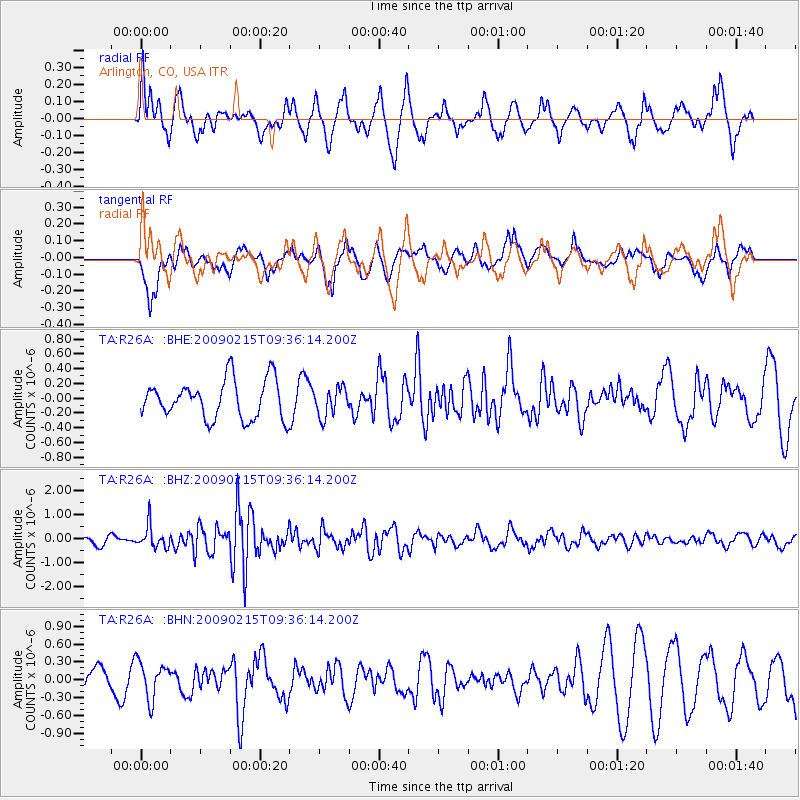
R26A Arlington, CO, USA - Earthquake Result Viewer
*The percent match for this event was below the threshold and hence no stack was calculated.
| Earthquake location: |
Near East Coast Of Honshu, Japan |
| Earthquake latitude/longitude: |
40.2/142.2 |
| Earthquake time(UTC): |
2009/02/15 (046) 09:24:31 GMT |
| Earthquake Depth: |
33 km |
| Earthquake Magnitude: |
6.1 MB, 5.5 MS, 5.7 MW, 5.7 MW |
| Earthquake Catalog/Contributor: |
WHDF/NEIC |
|
| Network: |
TA USArray Transportable Network (new EarthScope stations) |
| Station: |
R26A Arlington, CO, USA |
| Lat/Lon: |
38.30 N/103.45 W |
| Elevation: |
1304 m |
|
| Distance: |
81.4 deg |
| Az: |
46.477 deg |
| Baz: |
315.133 deg |
| Ray Param: |
$rayparam |
*The percent match for this event was below the threshold and hence was not used in the summary stack. |
|
| Radial Match: |
75.77595 % |
| Radial Bump: |
400 |
| Transverse Match: |
62.318233 % |
| Transverse Bump: |
400 |
| SOD ConfigId: |
2658 |
| Insert Time: |
2010-03-06 20:00:54.348 +0000 |
| GWidth: |
2.5 |
| Max Bumps: |
400 |
| Tol: |
0.001 |
|
Signal To Noise
| Channel | StoN | STA | LTA |
| TA:R26A: :BHZ:20090215T09:36:14.200Z | 2.0712492 | 4.6575184E-7 | 2.2486519E-7 |
| TA:R26A: :BHN:20090215T09:36:14.200Z | 1.7483213 | 3.0887068E-7 | 1.76667E-7 |
| TA:R26A: :BHE:20090215T09:36:14.200Z | 0.7421668 | 1.9252627E-7 | 2.5941105E-7 |
| Arrivals |
| Ps | |
| PpPs | |
| PsPs/PpSs | |


