You are here: Home > Network List > CN - Canadian National Seismograph Network Stations List
> Station INK INUVIK, NT > Earthquake Result Viewer
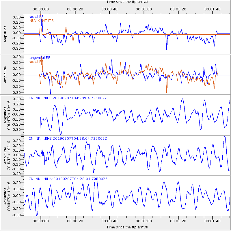
INK INUVIK, NT - Earthquake Result Viewer
*The percent match for this event was below the threshold and hence no stack was calculated.
| Earthquake location: |
Northern Molucca Sea |
| Earthquake latitude/longitude: |
1.5/126.5 |
| Earthquake time(UTC): |
2019/02/07 (038) 04:15:29 GMT |
| Earthquake Depth: |
35 km |
| Earthquake Magnitude: |
5.7 Mww |
| Earthquake Catalog/Contributor: |
NEIC PDE/us |
|
| Network: |
CN Canadian National Seismograph Network |
| Station: |
INK INUVIK, NT |
| Lat/Lon: |
68.31 N/133.53 W |
| Elevation: |
44 m |
|
| Distance: |
92.3 deg |
| Az: |
21.495 deg |
| Baz: |
279.864 deg |
| Ray Param: |
$rayparam |
*The percent match for this event was below the threshold and hence was not used in the summary stack. |
|
| Radial Match: |
52.4775 % |
| Radial Bump: |
400 |
| Transverse Match: |
56.96247 % |
| Transverse Bump: |
392 |
| SOD ConfigId: |
13570011 |
| Insert Time: |
2019-05-02 12:28:20.324 +0000 |
| GWidth: |
2.5 |
| Max Bumps: |
400 |
| Tol: |
0.001 |
|
Signal To Noise
| Channel | StoN | STA | LTA |
| CN:INK: :BHZ:20190207T04:28:04.725002Z | 0.42660934 | 7.787834E-8 | 1.825519E-7 |
| CN:INK: :BHN:20190207T04:28:04.725002Z | 0.94078076 | 9.8233635E-8 | 1.0441713E-7 |
| CN:INK: :BHE:20190207T04:28:04.725002Z | 0.7788674 | 1.1231977E-7 | 1.442091E-7 |
| Arrivals |
| Ps | |
| PpPs | |
| PsPs/PpSs | |


