You are here: Home > Network List > TA - USArray Transportable Network (new EarthScope stations) Stations List
> Station KSCO Kaye Shedlock's, Cheyenne Wells, CO, USA > Earthquake Result Viewer
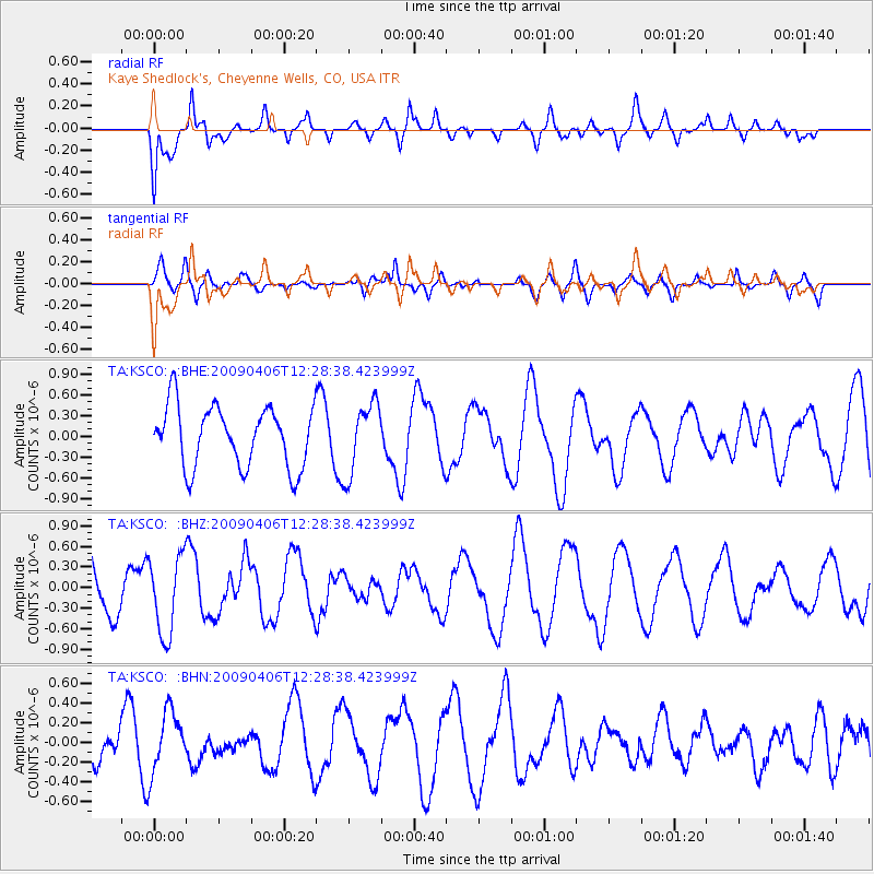
KSCO Kaye Shedlock's, Cheyenne Wells, CO, USA - Earthquake Result Viewer
*The percent match for this event was below the threshold and hence no stack was calculated.
| Earthquake location: |
Tonga Islands Region |
| Earthquake latitude/longitude: |
-22.4/-174.9 |
| Earthquake time(UTC): |
2009/04/06 (096) 12:16:08 GMT |
| Earthquake Depth: |
35 km |
| Earthquake Magnitude: |
5.5 MS, 5.4 MB |
| Earthquake Catalog/Contributor: |
WHDF/NEIC |
|
| Network: |
TA USArray Transportable Network (new EarthScope stations) |
| Station: |
KSCO Kaye Shedlock's, Cheyenne Wells, CO, USA |
| Lat/Lon: |
39.01 N/102.63 W |
| Elevation: |
1382 m |
|
| Distance: |
91.0 deg |
| Az: |
47.934 deg |
| Baz: |
241.877 deg |
| Ray Param: |
$rayparam |
*The percent match for this event was below the threshold and hence was not used in the summary stack. |
|
| Radial Match: |
71.66748 % |
| Radial Bump: |
400 |
| Transverse Match: |
61.087135 % |
| Transverse Bump: |
400 |
| SOD ConfigId: |
2658 |
| Insert Time: |
2010-03-06 20:02:31.864 +0000 |
| GWidth: |
2.5 |
| Max Bumps: |
400 |
| Tol: |
0.001 |
|
Signal To Noise
| Channel | StoN | STA | LTA |
| TA:KSCO: :BHZ:20090406T12:28:38.423999Z | 1.7017918 | 5.720523E-7 | 3.3614705E-7 |
| TA:KSCO: :BHN:20090406T12:28:38.423999Z | 1.3784077 | 3.1145447E-7 | 2.2595236E-7 |
| TA:KSCO: :BHE:20090406T12:28:38.423999Z | 1.1709013 | 5.168858E-7 | 4.414427E-7 |
| Arrivals |
| Ps | |
| PpPs | |
| PsPs/PpSs | |


