You are here: Home > Network List > TA - USArray Transportable Network (new EarthScope stations) Stations List
> Station S26A Kim, CO, USA > Earthquake Result Viewer
S26A Kim, CO, USA - Earthquake Result Viewer
| Earthquake location: |
Baffin Bay |
| Earthquake latitude/longitude: |
75.4/-72.5 |
| Earthquake time(UTC): |
2009/07/07 (188) 19:11:46 GMT |
| Earthquake Depth: |
19 km |
| Earthquake Magnitude: |
5.9 MB, 5.7 MS, 6.1 MW, 6.0 MW |
| Earthquake Catalog/Contributor: |
WHDF/NEIC |
|
| Network: |
TA USArray Transportable Network (new EarthScope stations) |
| Station: |
S26A Kim, CO, USA |
| Lat/Lon: |
37.62 N/103.47 W |
| Elevation: |
1394 m |
|
| Distance: |
40.4 deg |
| Az: |
219.105 deg |
| Baz: |
11.663 deg |
| Ray Param: |
0.07437583 |
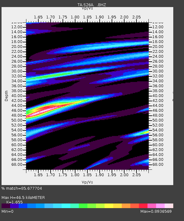
| Estimated Moho Depth: |
46.5 km |
| Estimated Crust Vp/Vs: |
1.65 |
| Assumed Crust Vp: |
6.306 km/s |
| Estimated Crust Vs: |
3.81 km/s |
| Estimated Crust Poisson's Ratio: |
0.21 |
|
| Radial Match: |
85.677704 % |
| Radial Bump: |
328 |
| Transverse Match: |
65.99742 % |
| Transverse Bump: |
400 |
| SOD ConfigId: |
2648 |
| Insert Time: |
2010-03-06 20:03:16.080 +0000 |
| GWidth: |
2.5 |
| Max Bumps: |
400 |
| Tol: |
0.001 |
|
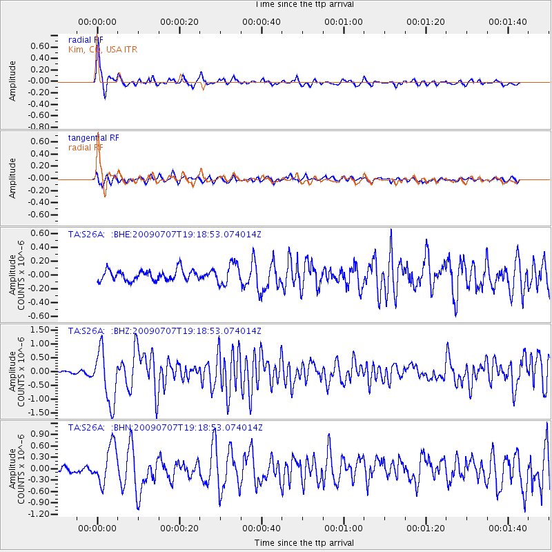
Signal To Noise
| Channel | StoN | STA | LTA |
| TA:S26A: :BHZ:20090707T19:18:53.074014Z | 14.670166 | 9.674598E-7 | 6.594743E-8 |
| TA:S26A: :BHN:20090707T19:18:53.074014Z | 5.9565644 | 5.146983E-7 | 8.640858E-8 |
| TA:S26A: :BHE:20090707T19:18:53.074014Z | 2.0094917 | 1.5364586E-7 | 7.646006E-8 |
| Arrivals |
| Ps | 5.2 SECOND |
| PpPs | 18 SECOND |
| PsPs/PpSs | 23 SECOND |


