S26A Kim, CO, USA - Earthquake Result Viewer
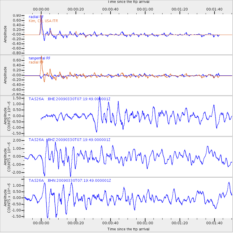
Earthquake location: Kodiak Island Region, Alaska
Earthquake latitude/longitude: 56.5/-152.7
Earthquake time(UTC): 2009/03/30 (089) 07:13:07 GMT
Earthquake Depth: 21 km
Earthquake Magnitude: 5.9 MB, 5.9 MS, 5.9 MW, 5.9 MW
Earthquake Catalog/Contributor: WHDF/NEIC
Network: TA USArray Transportable Network (new EarthScope stations)
Station: S26A Kim, CO, USA
Lat/Lon: 37.62 N/103.47 W
Elevation: 1394 m
Distance: 37.5 deg
Az: 98.944 deg
Baz: 316.447 deg
Ray Param: 0.07606025
Estimated Moho Depth: 26.25 km
Estimated Crust Vp/Vs: 1.85
Assumed Crust Vp: 6.306 km/s
Estimated Crust Vs: 3.404 km/s
Estimated Crust Poisson's Ratio: 0.29
Radial Match: 86.496284 %
Radial Bump: 296
Transverse Match: 57.862957 %
Transverse Bump: 400
SOD ConfigId: 2658
Insert Time: 2010-03-06 20:03:18.080 +0000
GWidth: 2.5
Max Bumps: 400
Tol: 0.001

Signal To Noise

ChannelStoNSTALTA
TA:S26A: :BHZ:20090330T07:19:49.000001Z7.05064961.2353819E-61.7521533E-7
TA:S26A: :BHN:20090330T07:19:49.000001Z5.49116668.322611E-71.5156363E-7
TA:S26A: :BHE:20090330T07:19:49.000001Z5.60237748.3035206E-71.4821424E-7
Arrivals
Ps3.8 SECOND
PpPs11 SECOND
PsPs/PpSs15 SECOND