You are here: Home > Network List > TS - TERRAscope (Southern California Seismic Network) Stations List
> Station CALB Calabasas, California, USA > Earthquake Result Viewer
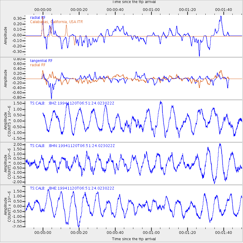
CALB Calabasas, California, USA - Earthquake Result Viewer
*The percent match for this event was below the threshold and hence no stack was calculated.
| Earthquake location: |
Vanuatu Islands Region |
| Earthquake latitude/longitude: |
-20.7/172.7 |
| Earthquake time(UTC): |
1994/11/20 (324) 06:39:21 GMT |
| Earthquake Depth: |
24 km |
| Earthquake Magnitude: |
5.5 MB, 5.6 MS, 5.5 UNKNOWN |
| Earthquake Catalog/Contributor: |
WHDF/NEIC |
|
| Network: |
TS TERRAscope (Southern California Seismic Network) |
| Station: |
CALB Calabasas, California, USA |
| Lat/Lon: |
34.14 N/118.63 W |
| Elevation: |
0.0 m |
|
| Distance: |
85.1 deg |
| Az: |
50.83 deg |
| Baz: |
241.039 deg |
| Ray Param: |
$rayparam |
*The percent match for this event was below the threshold and hence was not used in the summary stack. |
|
| Radial Match: |
43.234066 % |
| Radial Bump: |
400 |
| Transverse Match: |
63.323677 % |
| Transverse Bump: |
400 |
| SOD ConfigId: |
4480 |
| Insert Time: |
2010-02-26 14:05:24.578 +0000 |
| GWidth: |
2.5 |
| Max Bumps: |
400 |
| Tol: |
0.001 |
|
Signal To Noise
| Channel | StoN | STA | LTA |
| TS:CALB: :BHN:19941120T06:51:24.023022Z | 1.6171627 | 5.37702E-7 | 3.3249717E-7 |
| TS:CALB: :BHE:19941120T06:51:24.023022Z | 2.8098984 | 9.752549E-7 | 3.4707836E-7 |
| TS:CALB: :BHZ:19941120T06:51:24.023022Z | 0.9760567 | 7.0556484E-7 | 7.228728E-7 |
| Arrivals |
| Ps | |
| PpPs | |
| PsPs/PpSs | |


